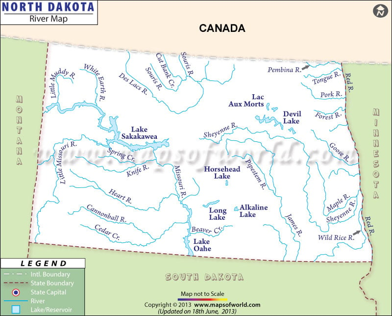
North Dakota River Map marks the major waterways of the state. Missouri, James and Red rivers are the perennial resources of North Dakota. While Missouri River starts from the northwest of North Dakota and flows towards east, Red river goes towards Canada which is towards the north of the state. All the three rivers of North Dakota have significant contribution towards the agriculture industry of the state.
The irrigation facility has improved a lot due to the three rivers of North Dakota. The river map of North Dakota clearly indicates the cities and towns which are situated on the banks of the prime rivers of the state.
Cities like Mandan, Bismarck, Williston, Fargo, Ellendale, Underwood and many others all of which are intersected by the rivers of the state are depicted in the North Dakota river map. Apart from having a natural beauty the rivers of North Dakota also offer scope for tourism.
The North Dakota state map provides important information regarding the rivers of the place. The Red River of North Dakota, for instance, provides opportunity for excellent fishing session. Tourists from many parts of the world come to explore the splashing splendor of North Dakota rivers throughout the year.
 Wall Maps