- Missouri Counties - Missouri County Map, Map of Missouri Counties
- Major Cities of Missouri - Kansas City, St Louis, Branson
- Neighbouring States - Iowa, Illinois, Kentucky, Tennessee, Arkansas, Oklahoma, Kansas, Nebraska
- Regional Maps - Map of USA
- Other Missouri Maps - Missouri Map, Missouri Physical Map, Missouri Airports Map, Missouri Lat Long Map, Missori Zip Code Map, Missouri Area Code Map
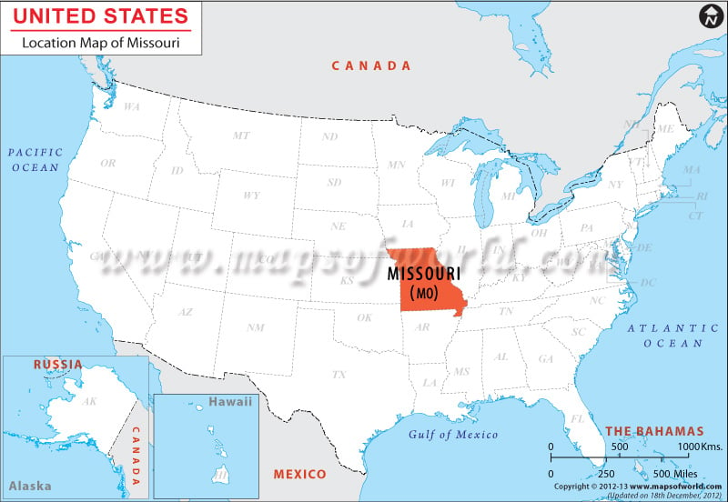
Situated in the western edge of the north-central United States, within the coordinates 38.5° N and 92.5° W, Missouri covers an area of 112,167 square miles. While Illinois borders Missouri on the east, Nebraska, Kansas and Oklahoma share the western border of the state. Missouri is bound by Arkansas on the south, and Iowa forms the northern boundary of the state.
Facts About Missouri
| State Name | Missouri |
|---|---|
| Country | USA |
| Continent | North America |
| Capital | Missouri |
| Largest city | Kansas City |
| Area | 69,709 sq mi (180,533 km2) |
| Population | 6,063,589 (2014 est.) |
| Lat Long | 38° 30′ 0″ N, 92° 30′ 0″ W |
| Official Language | English |
| Calling Code | |
| Time Zone | Central: UTC −6/−5 |
| Airport | 60 Airports |
| Neighbour countries | Mexico, Canada |
| Internet TLD | .mo |
| Currency | US Dollar |
 Wall Maps