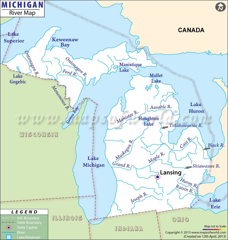
Michigan River Map shows the prominent waterways that play a significant role in enhancing the natural splendor and commercial viability of the state.
Grand, St. Mary’s, Pere Marquettte, Manistee, Muskegon, Kalamazoo, Detroit and St. Clair are some of the prime rivers of Michigan. With a 262 mile stream, the Grand River is the longest waterway of the state and passes through the lower peninsula before draining into Lake Michigan.
The river map of Michigan also highlights the major lakes of the state: Lake Michigan, Lake St. Clair, Lake Huron, and Lake Erie. Michigan also boasts of Tahquamenon Falls, located on the eastern front of Upper Peninsula. There are a total of 62 watersheds in the state, however the Saginaw river and its 8,000 sq miles is the largest one. Some of the major rivers that fall into Lake Huron include Cheboygan, Thunder Bay and Au Sable.
The Michigan river map, apart from the watersheds, lakes, and streams, also marks the towns and cities that are located on the banks of these waterways.
 Wall Maps