2.3K
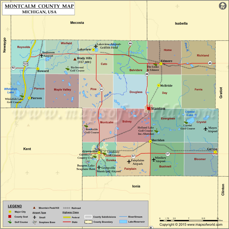
Mountain Peaks in Montcalm County
| Mountain Peak/Hill | Elevation [Meter] |
|---|---|
| Brady Hills | 317 |
| Maple Hill | 274 |
Airports in Montcalm County
| Airport Name |
|---|
| Anderson Airport |
| Burgess Lake Seaplane Base |
| Fairplains Airpark |
| Greenville Municipal Airport |
| Lakeview-Airport-Griffith Field |
| Mayes Airport |
| Minikey Airport |
Cities in Montcalm County
| City | Population | Latitude | Longitude |
|---|---|---|---|
| Carson City city | 1093 | 43.181372 | -84.846055 |
| Edmore village | 1201 | 43.407333 | -85.036793 |
| Greenville city | 8481 | 43.179705 | -85.253449 |
| Howard City village | 1808 | 43.3943 | -85.468164 |
| Lakeview village | 1007 | 43.44315 | -85.27327 |
| McBride village | 205 | 43.35202 | -85.044196 |
| Pierson village | 172 | 43.319647 | -85.497502 |
| Sheridan village | 649 | 43.208628 | -85.073932 |
| Stanton city | 1417 | 43.292807 | -85.078881 |
 Wall Maps