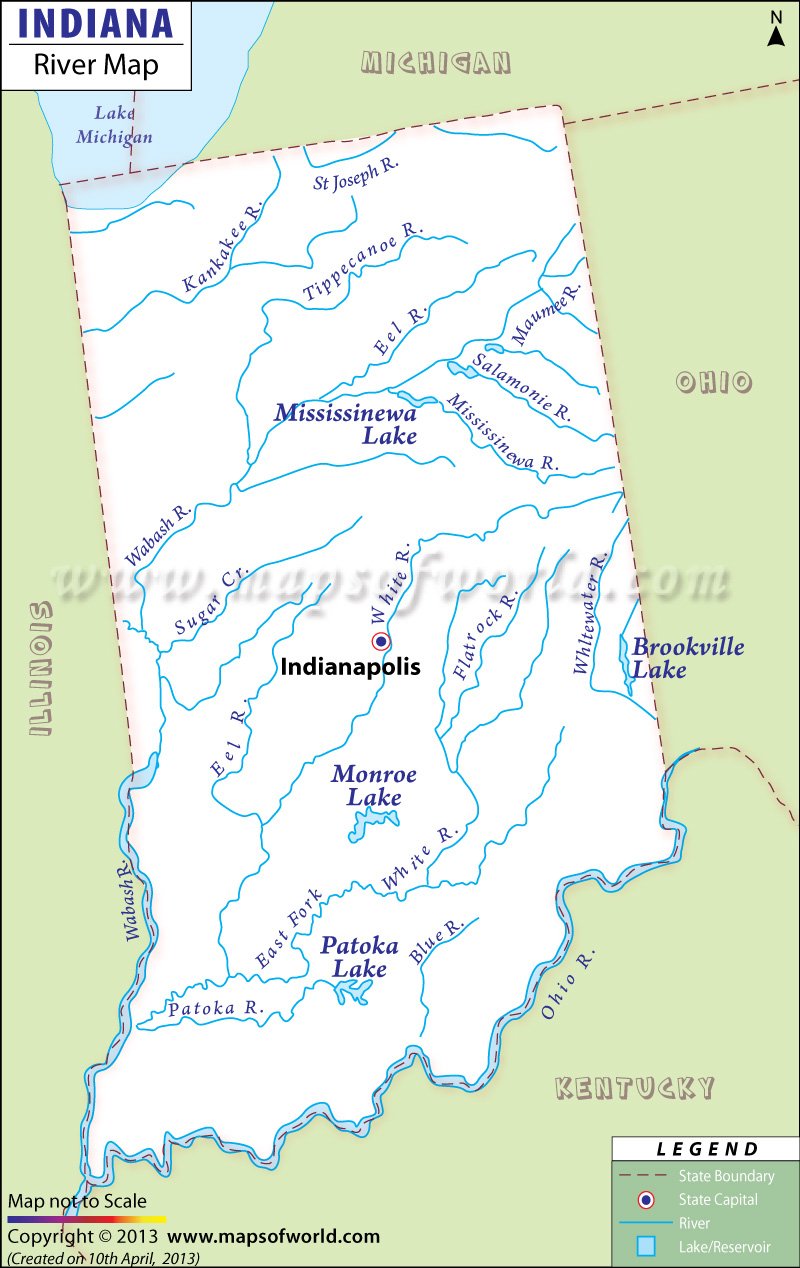
The Indiana River Map prominently marks the several rivers, natural streams, and lakes throughout the state.
The northern part of Indiana is located in the watershed zone of the St. Lawrence River. The natural streams of this area flow into the Maumee River or Lake Michigan. The rest of Indiana is in the watershed drainage area of the Mississippi River, and the streams of the area flow into the Ohio, Kankakee, and Wabash Rivers. The Indiana River Map highlights the direction of flow of these rivers. Some of the prominent rivers of Indiana are the White River, Ohio River, Tippecanoe River, and Wabash River.
The Wabash River flows from the west, through the north-central section of the state, and south into the Ohio, Eel, Tippecanoe, Mississinewa, and White Rivers. The Maumee and Kankakee Rivers flow through northern Indiana. In southwestern Indiana, the rivers drain into the White River which flows into the Wabash River. Whitewater River flows across the southeastern part of Indiana and drains into the Ohio River. Lake Mississinewa and Lake Michigan are the two most important lakes of Indiana, while Lake Monroe and Lake Patoka are the states’ other notable lakes.
 Wall Maps