1.4K
Airports in Shelby County
| Airport Name |
|---|
| Enoch Airport |
| Hilvety Airport |
| Howell Airport |
| Paul E. Kroenlein Airport |
| Shelby County Airport |
| Shelby Memorial Hospital Heliport |
| Williamson Airport |
More Maps of Shelby County
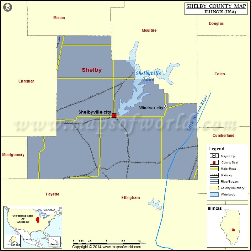
Cities in Shelby County
| City | Population | Latitude | Longitude |
|---|---|---|---|
| Cowden village | 629 | 39.249224 | -88.859351 |
| Findlay village | 683 | 39.522341 | -88.754593 |
| Herrick village | 436 | 39.219616 | -88.984789 |
| Moweaqua village | 1831 | 39.624671 | -89.022066 |
| Oconee village | 180 | 39.286306 | -89.10661 |
| Shelbyville city | 4700 | 39.409584 | -88.799103 |
| Sigel town | 373 | 39.225661 | -88.494495 |
| Stewardson village | 734 | 39.263979 | -88.630123 |
| Strasburg village | 467 | 39.349686 | -88.621218 |
| Tower Hill village | 611 | 39.386774 | -88.959249 |
| Westervelt | 128 | 39.479058 | -88.861198 |
| Windsor city | 1187 | 39.4389 | -88.595389 |
Golf Courses in Shelby County
| Name of Golf Course | Latitude | Longitude |
|---|---|---|
| Angus Links Golf Course-Windsor | 39.436245 | -88.595024 |
| Deer Trail Golf Club At Lake Shelbyville-Shelbyville | 39.43238 | -88.781483 |
| Eagle Creek Resort Golf Course-Findlay | 39.521679 | -88.754219 |
| Moweaqua Golf Course-Moweaqua | 39.63117 | -88.847464 |
 Wall Maps