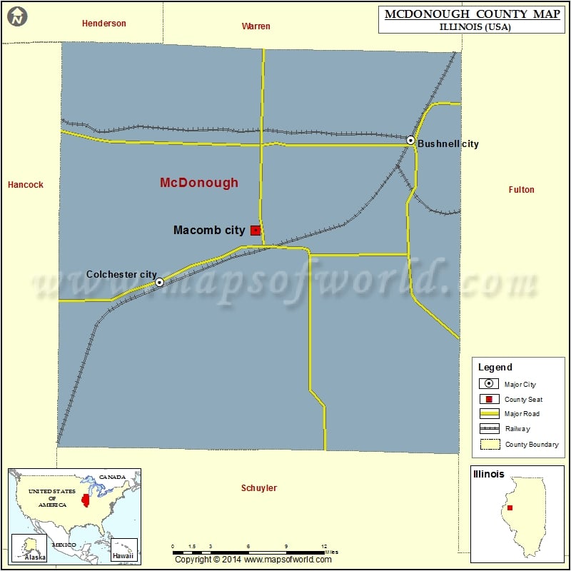
1.1K
Mountain Peaks in McDonough County
| Mountain Peak/Hill | Elevation [Meter] |
|---|---|
| Dyers Mound | 221 |
Airports in McDonough County
| Airport Name |
|---|
| Clark Airport |
| Holyoke Airport |
| Macomb Municipal Airport |
| Mount Werner Heliport |
| Munsterman Airport |
| Rdh Farms Airport |
| St Francis Hospital Heliport |
Cities in McDonough County
| City | Population | Latitude | Longitude |
|---|---|---|---|
| Adair | 210 | 40.418307 | -90.497373 |
| Bardolph village | 251 | 40.496274 | -90.563391 |
| Blandinsville village | 651 | 40.554139 | -90.868055 |
| Bushnell city | 3117 | 40.551786 | -90.504509 |
| Colchester city | 1401 | 40.427318 | -90.792147 |
| Georgetown | 404 | 40.459834 | -90.717372 |
| Good Hope village | 396 | 40.557454 | -90.675539 |
| Industry village | 478 | 40.32696 | -90.608182 |
| Macomb city | 19288 | 40.472265 | -90.682218 |
| Prairie City village | 379 | 40.621025 | -90.464906 |
| Sciota village | 61 | 40.562428 | -90.748036 |
| Tennessee village | 115 | 40.411218 | -90.836061 |
Golf Courses in McDonough County
| Name of Golf Course | Latitude | Longitude |
|---|---|---|
| Gold Hills Golf Course-Colchester | 40.441922 | -90.734099 |
| Harry Mussatto Golf Course At Western Illinois Uni-Macomb | 40.485267 | -90.693678 |
| Macomb Country Club-Macomb | 40.476365 | -90.6653 |
| Shaw Creek Golf Course-Bushnell | 40.548781 | -90.502733 |
| Twin Oaks Golf & Country Club-Blandinsville | 40.554926 | -90.879479 |
 Wall Maps