1K
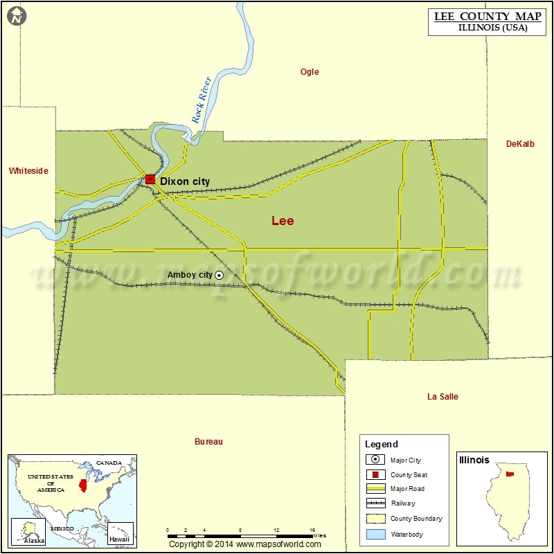
Airports in Lee County
| Airport Name |
|---|
| Albrecht /2/ Airport |
| Amboy Fire Protection District Heliport |
| Bally’s Strip |
| Bernardin Heliport |
| Bresson Airport |
| Butler Hill RLA Restricted Landing Area |
| Dixon Correctional Center Heliport |
| Dixon Municipal Charles R. Walgreen Field |
| Dunn Airport |
| Earl Barnickel Airport |
| Gearhart-Hollow Heliport |
| Gehant Airport |
| Gittleson Farms Airport |
| Home Free Airport |
| J & Y Ultralightport |
| Katherine Shaw Bethea Hospital Heliport |
| Miller Airport |
| Ranken Airport |
| Staton Airport |
| Sword’s Heliport |
| Taylor Airport |
| Thompson Airport |
| W Davis Airport |
| Walder’s Farm Airport |
| Woodbine Municipal Airport |
More Maps of Lee County
- Lee County Map, South Carolina
- Lee County Map, Alabama
- Lee County Map, Florida
- Lee County Map, North Carolina
- Lee County Map, Texas
- Lee County Map, Georgia
Cities in Lee County
| City | Population | Latitude | Longitude |
|---|---|---|---|
| Amboy city | 2500 | 41.728957 | -89.367674 |
| Ashton village | 972 | 41.868214 | -89.222422 |
| Compton Village | 303 | 41.694024 | -89.086087 |
| Dixon city | 15733 | 41.843512 | -89.478566 |
| Franklin Grove Village | 1021 | 41.840944 | -89.300569 |
| Harmon village | 120 | 41.719403 | -89.556128 |
| Lee village | 337 | 41.79448 | -88.941453 |
| Nelson village | 170 | 41.796094 | -89.603534 |
| Paw Paw village | 870 | 41.687519 | -88.980865 |
| Steward village | 256 | 41.848826 | -89.016515 |
| Sublette village | 449 | 41.643701 | -89.23118 |
| West Brooklyn village | 142 | 41.692802 | -89.147305 |
Golf Courses in Lee County
| Name of Golf Course | Latitude | Longitude |
|---|---|---|
| Emerald Hill Golf & Learning Center-Sterling | 41.84095 | -89.612059 |
| Miller Golf Complex-Dixon | 41.85945 | -89.479228 |
| Shady Oaks Country Club-Amboy | 41.631905 | -89.458424 |
| Timber Creek Golf-Dixon | 41.87346 | -89.491011 |
 Wall Maps