1.3K
Mountain Peaks in Lawrence County
| Mountain Peak/Hill | Elevation [Meter] |
|---|---|
| Red Hill | 193 |
| Robeson Hills | 153 |
More Maps of Lawrence County
Airports in Lawrence County
| Airport Name |
|---|
| Il Dept of Corrections/Lawrence County Heliport |
| Lawrence Co Memorial Hospital Heliport |
| Lawrenceville Vincennes International Airport |
| Mount Carmel Municipal Airport |
| O’Neal Airport |
| Piper’s Landing Airport |
Cities in Lawrence County
| City | Population | Latitude | Longitude |
|---|---|---|---|
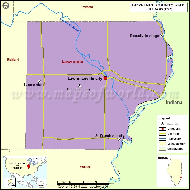
| Bridgeport city | 1886 | 38.709419 | -87.759096 |
| Lawrenceville city | 4348 | 38.726299 | -87.687402 |
| Russellville village | 94 | 38.819776 | -87.53001 |
| St. Francisville city | 697 | 38.591852 | -87.647455 |
| Sumner city | 3174 | 38.71961 | -87.872393 |
Golf Courses in Lawrence County
| Name of Golf Course | Latitude | Longitude |
|---|---|---|
| Cedarbrooke Par 3 Golf Inc.-Sumner | 38.753911 | -87.833198 |
| Lawrence County Country Club-Lawrenceville | 38.72779 | -87.722059 |
 Wall Maps