1.6K
Mountain Peaks in Greene County
| Mountain Peak/Hill | Elevation [Meter] |
|---|---|
| Shanks Hill | 182 |
| Spankey Hill | 208 |
| Witachek Mound | 208 |
| Zerby Hill | 188 |
More maps of Greene County
- Greene County Map, Alabama
- Greene County Map, New York
- Greene County Map, Tennessee
- Greene County Map, Georgia
Airports in Greene County
| Airport Name |
|---|
| Arras RLA Restricted Landing Area |
| Boyd Hospital Heliport |
| Hartwell Ranch RLA Restricted Landing Area |
| Martin Airport |
| Newton Airport |
| Smith Restricted Landing Area |
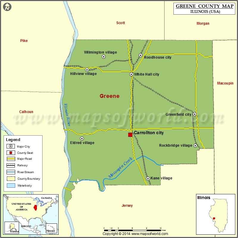
Cities in Greene County
| City | Population | Latitude | Longitude |
|---|---|---|---|
| Carrollton city | 2484 | 39.294813 | -90.406204 |
| Eldred village | 201 | 39.286151 | -90.553975 |
| Greenfield city | 1071 | 39.344306 | -90.208026 |
| Hillview village | 193 | 39.449555 | -90.538574 |
| Kane village | 438 | 39.190489 | -90.35118 |
| Rockbridge village | 169 | 39.269275 | -90.206552 |
| Roodhouse city | 1814 | 39.484053 | -90.374035 |
| White Hall city | 2520 | 39.438793 | -90.40193 |
| Wilmington village | 142 | 39.480683 | -90.486766 |
Golf Courses in Greene County
| Name of Golf Course | Latitude | Longitude |
|---|---|---|
| Lone Oak Golf Course-Carrollton | 39.302061 | -90.395869 |
 Wall Maps