1.1K
Mountain Peaks in Clinton County
| Mountain Peak/Hill | Elevation [Meter] |
|---|---|
| Browns Hill | 165 |
| Corcoran Hill | 163 |
| Heimanns Hill | 129 |
| Schaeffer Hill | 161 |
More Maps of Clinton County
Airports in Clinton County
| Airport Name |
|---|
| Centralia Correctional Center Heliport |
| Fischer’s RLA Restricted Landing Area |
| Linders Cow-Chip Airport |
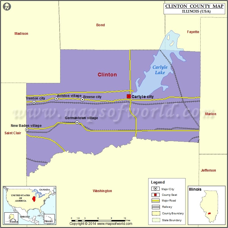
Cities in Clinton County
| City | Population | Latitude | Longitude |
|---|---|---|---|
| Albers village | 1190 | 38.545184 | -89.614287 |
| Aviston village | 1945 | 38.616347 | -89.608985 |
| Bartelso village | 595 | 38.537283 | -89.467571 |
| Beckemeyer village | 1040 | 38.605801 | -89.432271 |
| Breese city | 4442 | 38.61378 | -89.52303 |
| Carlyle city | 3281 | 38.621803 | -89.373307 |
| Damiansville village | 491 | 38.508777 | -89.615019 |
| Germantown village | 1269 | 38.555238 | -89.540514 |
| Hoffman village | 508 | 38.540488 | -89.264339 |
| Huey village | 169 | 38.605285 | -89.289972 |
| New Baden village | 3349 | 38.536568 | -89.7043 |
| Trenton city | 2715 | 38.607 | -89.6805 |
Golf Courses in Clinton County
| Name of Golf Course | Latitude | Longitude |
|---|---|---|
| Bent Oak Golf Course-Breese | 38.605529 | -89.511635 |
| Carlyle Lake Golf Club-Carlyle | 38.592018 | -89.373102 |
| Flying M Ranch Golf Club-Centralia | 38.506469 | -89.195132 |
| Governor’s Run Golf Course-Carlyle | 38.634821 | -89.36606 |
 Wall Maps