1.1K
Mountain Peaks in Christian County
| Mountain Peak/Hill | Elevation [Meter] |
|---|---|
| Long Mound | 207 |
Airports in Christian County
| Airport Name |
|---|
| Hardy Airport |
| Mc Christy Airport |
| Noland RLA Restricted Landing Area |
| Pana Community Hospital Heliport |
| Red Canyon Ranch Heliport |
| Rio Blanco Heliport |
| Taylorville Municipal Airport |
| Tommy’s Airpark |
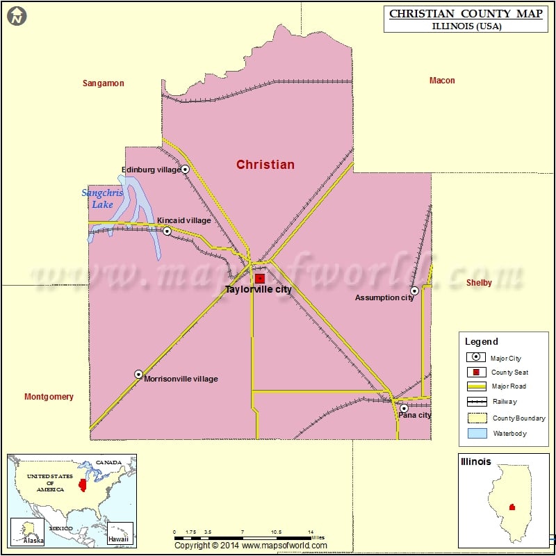
Cities in Christian County
| City | Population | Latitude | Longitude |
|---|---|---|---|
| Assumption city | 1168 | 39.517796 | -89.048468 |
| Bulpitt village | 222 | 39.591911 | -89.425761 |
| Edinburg village | 1078 | 39.65789 | -89.390121 |
| Jeisyville village | 107 | 39.579204 | -89.40806 |
| Kincaid village | 1505 | 39.586831 | -89.416539 |
| Langleyville | 432 | 39.561107 | -89.360255 |
| Morrisonville village | 1056 | 39.421668 | -89.459007 |
| Mount Auburn village | 480 | 39.764892 | -89.260792 |
| Owaneco village | 239 | 39.481426 | -89.194865 |
| Palmer village | 229 | 39.458677 | -89.407923 |
| Pana city | 5847 | 39.382866 | -89.0643 |
| Stonington village | 932 | 39.638532 | -89.192109 |
| Taylorville city | 11246 | 39.531872 | -89.279379 |
| Tovey village | 512 | 39.588244 | -89.448566 |
Golf Courses in Christian County
| Name of Golf Course | Latitude | Longitude |
|---|---|---|
| Lake Shore Golf Course-Taylorville | 39.494448 | -89.266357 |
| Lincoln Trail Golf Club-Taylorville | 39.552831 | -89.271053 |
| Oak Terrace Resort-Pana | 39.388877 | -89.068768 |
| Pana Country Club-Pana | 39.379407 | -89.077995 |
 Wall Maps