- Idaho Counties - Idaho County Map, Map of Idaho Counties
- Major Cities of Idaho - Twin Falls City, Idaho Falls City, Boise, Coeur d'alene
- Neighbouring States - Washington, Oregon, Nevada, Utah, Montana, Wyoming
- Regional Maps - Map of USA
- Other Idaho Maps - Idaho Map, Where is Idaho, Idaho Airports Map, Idaho Lat Long Map, Idaho Zip Code Map, Idaho Area Code Map, Idaho National Parks Map
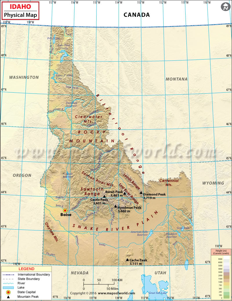
Idaho borders six US states (Washington, Oregon, Nevada, Utah, Montana, and Wyoming) and the Canadian province of British Columbia. The state features snow-capped mountain ranges, white rapids, vast lakes, and deep canyons.
The state’s landscape is rugged with vast unspoiled wilderness in the US. At 2.3 million acres, the Frank Church-River of No Return Wilderness Area is the largest contiguous area of protected wilderness in the continental US. The highest point in Idaho is Borah Peak, at 3,859 meters, in the Lost River Range. The Idaho Panhandle lies in the northern Idaho. The region is isolated from southern Idaho as the east-west mountain ranges separate the two. The Palouse region features fertile hills and prairies north of the Snake River. The Snake River Plain is a flat, bow-shaped depression running through south-central Idaho.
The Sawtooth Range is arguably Idaho’s most famous mountain range. Other mountain ranges in Idaho include the Bitterroot Range, the White Cloud Mountains, the Lost River Range, the Clearwater Mountains, and the Salmon River Mountains. The Continental Divide indicates where on either side of rivers will flow downhill, to the east or west. The waters of the Snake River rush through Hells Canyon, the deepest gorge in the US. Shoshone Falls, which are taller than Niagara Falls, plunges down from a height of about 200 feet.
 Wall Maps
