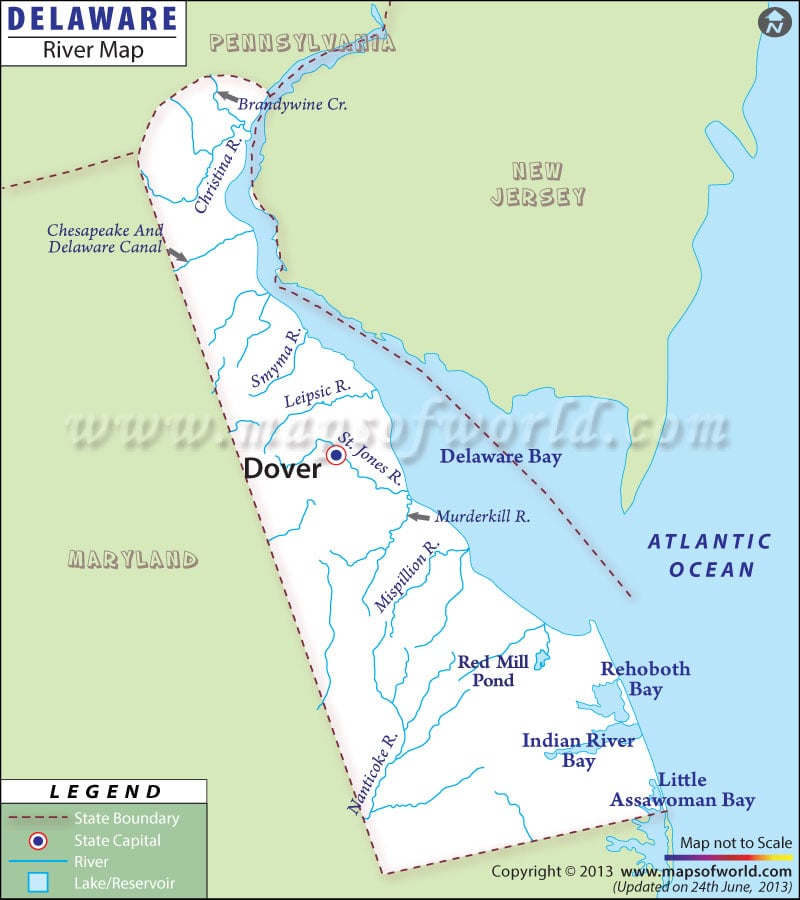
The Delaware Rivers Map highlights the major waterways of the state. Some of Delaware’s prominent rivers include the Choptank, Delaware, Nanticoke, Pocomoke, Appoquinimik, St. Jones, Christina, Smyma, Mispillion, Leipsic, Murderkill, and Broadkill rivers, all of which are featured on the Delaware Rivers Map.
The Delaware river is the main perennial resource of the state. The lower part of Delaware river estuary is called the Delaware Bay. Rivers such as the Leipsic, Christina, Murderkill, Mispillion, Appoquinimink, Broadkill, and St. Jones drain to the Delaware Bay, whereas, the Pocomoke, Choptank, and Nanticoke rivers lead to Chesapeake Bay. The Chesapeake and Delaware Canals, as shown on the Delaware River Map, connect the Chesapeake Bay and Delaware Bay.
Red Mill Pond is also featured on the Delaware River Map.
The lakes of Delaware state offer a fabulous opportunity for fishing and boating. Apart from the natural streams, the Delaware river map also shows the location of neighboring states such as Maryland, New Jersey, and Pennsylvania. The rivers of Delaware are significant in the agricultural industry of the state. The Delaware River Map is a useful tool for tourists coming to explore the natural streams of the state.
Locations in the Map :
TOWNS/CITIES IN DELAWARE :
Wilmington, Dover, Lewes, Georgetown
NEIGHBORING STATES :
Pennsylvania, New Jersey, Maryland
Bodies of water : Atlantic Ocean
 Wall Maps