
 Wall Maps
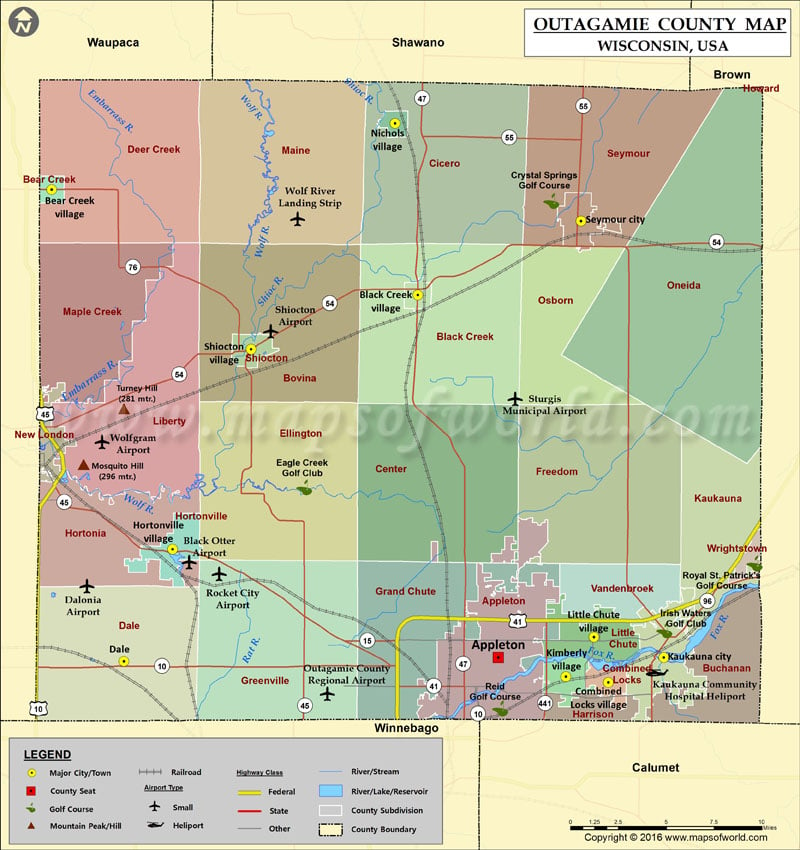
Outagamie County Map for free download. Printable map of Outagamie County, Wisconsin (USA) showing the County boundaries, County seat, major cities, roads, and rail network.
Check this Wisconsin County Map to locate all the state’s counties on Wisconsin Map.