Wall Maps
Calumet County Map for free download. Printable map of Calumet County, Wisconsin (USA) showing the County boundaries, County seat, major cities, roads, and rail network.
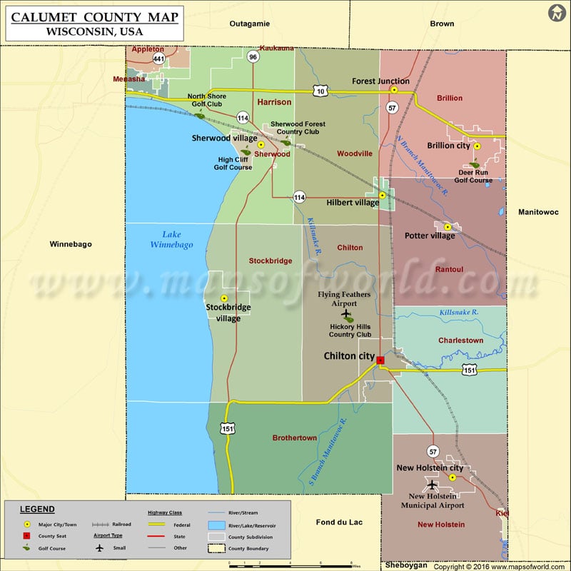
Calumet County Map, Wisconsin
Calumet County Map for free download. Printable map of Calumet County, Wisconsin (USA) showing the County boundaries, County seat, major cities, roads, and rail network.