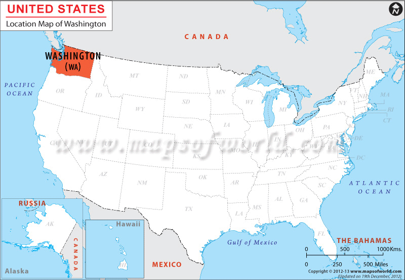
Where is Washington State Located?
The Washington Location Map offers information about the geographical standing of the state. While Idaho borders the state on the eastern side, Oregon shares the southern border. Pacific Ocean surrounds it from the west and the country Canada surrounds the state from the north. Occupying a total of 176, 477 sq km Washington has a 1769 km long boundary. The boundary of Washington also comprises 253 km long coastline. The north to south region of Washington stretches to a total of 390 km, while the east to west zone of the state is 580 km long.
Facts About Washington |
|---|
| State Name | Washington |
|---|---|
| Continent | North America |
| Country | United State (USA) |
| Capital | Olympia |
| Largest city | Seattle |
| Area | 71,362 sq mi (184,827 km2) |
| Population | 7,061,530 (2014 est) |
| Lat Long | 47° 30′ 0″ N, 120° 30′ 0″ W |
| Official Language | None (de jure) English (de facto) |
| Calling Code | 00 1 360 X (Olympia), 00 1 206 X (Seattle) |
| Time Zone | Pacific: UTC −8/−7 |
| Airport | 12-Airports Scheduled |
| Neighbour State | Oregon, Idaho |
| Internet TLD | .wa |
| Currency | United State Dollar (USD) |

 Wall Maps