
 Wall Maps
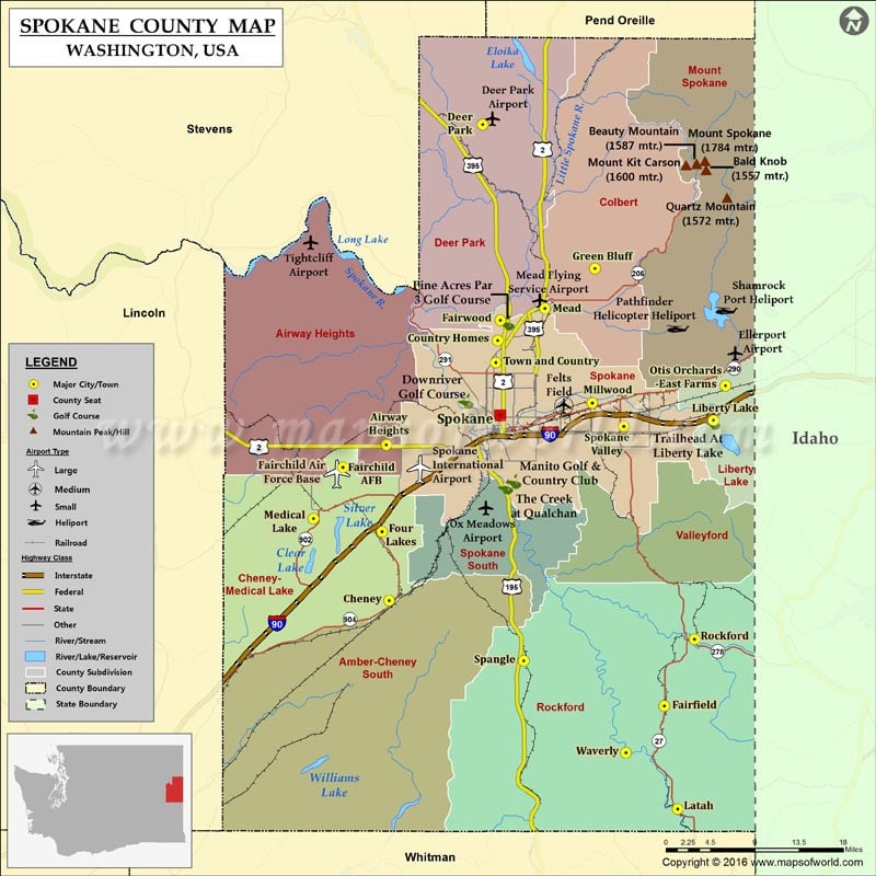
Check this Washington County Map to locate all the state’s counties in Washington Map.
Facts about Spokane county in Washington |
|
|---|---|
| County Name | Spokane county |
| Population | 4,84,318 |
| Founded | January 29, 1858, and October 30, 1879 |
| Area | 1,781 sq mi (4,613 sq km) |
| Land Area | 1,764 sq mi (4,569 sq km) |
| Water Area | 17 sq mi (44 sq km), 0.9% |
| Largest City | Spokane |
| Cities | Airway Heights, Greenacres, Rockford, Mica, Trentwood, Latah, Millwood, Deer Park, Spokane Valley, Liberty Lake, Medical Lake, Spangle, Fairfield, Opportunity, Dishman, Waverly, Four Lakes, Veradale, Cheney, Spokane |
| County Seat | Spokane |
| Timezone | Pacific: UTC-8/-7 |