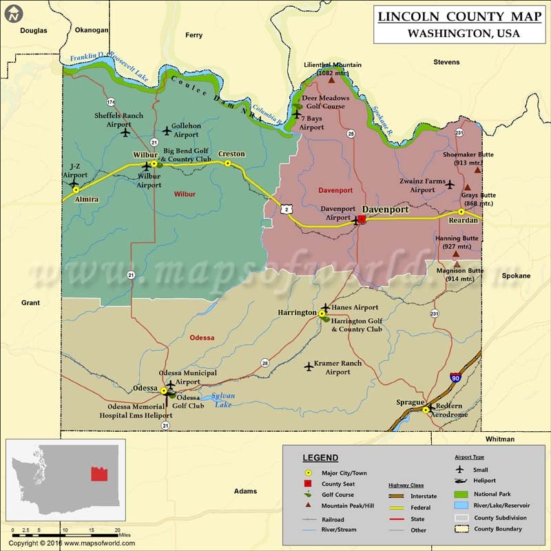
Check this Washington County Map to locate all the state’s counties in Washington Map.
Lincoln County is a county located in eastern Washington. It is the fifth least populous county in the state. Davenport is the county seat and the largest city. Harrington and Sprague are other cities with significant populations. The county was established on November 24, 1883, and is named for the 16th US President Abraham Lincoln. The county covers a total area of 2,339 square miles. Agriculture, primarily wheat farming, is the mainstay of the county’s economy. Interstate 90, US Route 2, and US Route 395 are major roads connecting the towns in Washington. The Columbia River the largest river in the Pacific Northwest – defines most of the northern boundary of Lincoln County. The Grand Coulee Dam on the Columbia is located near the county’s northwestern corner.
More maps of Lincoln County
- Lincoln County Map, Wisconsin
- Lincoln County Map, South Dakota
- Lincoln County Map, Nebraska
- Lincoln County Map, North Carolina
- Lincoln County Map, Tennessee
- Lincoln County Map, Georgia
Facts about Lincoln county in Washington |
|
|---|---|
| County Name | Lincoln county |
| Population | 10,250 |
| Founded | 24 November 1883 |
| Area | 2,339 sq mi (6,058 sq km) |
| Land Area | 2,310 sq mi (5,983 sq km) |
| Water Area | 29 sq mi (75 sq km), 1.2% |
| Largest City | Davenport |
| Cities | Davenport, Sprague, Odessa, Reardan, Wilbur, Harrington, Creston, Almira, Edwall, Lincoln, Lamona, Irby |
| County Seat | Davenport |
| Timezone | Pacific: UTC-8/-7 |

 Wall Maps