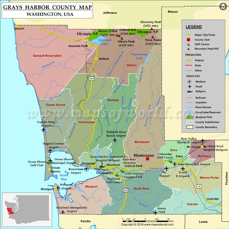
Check this Washington County Map to locate all the state’s counties in Washington Map.
Bounded by the Olympic Mountains and the Pacific Ocean, Grays Harbor County is located in western Washington. Founded on April 14, 1854, it covers an overall area of 2,224 square miles. The county seat is Montesano and its largest city is Aberdeen. Known as ‘Gateway to the Olympic Peninsula,’ Aberdeen is the hometown of Nirvana singer Kurt Cobain. Chehalis and Quinault are two Indian reservations in the county.
Westhaven State Park and Twin Harbors State Park are popular for fishing & camping while Lake Sylvia State Park offers hiking and birding. Fort Chehalis, Westport Docks, and Lake Quinault are major points of interest in the county. U.S. Route 12, U.S. Route 101, and SR 8 are major roads in Grays Harbor County.
Facts about Grays Harbor county in Washington |
|
|---|---|
| County Name | Grays Harbor county |
| Population | 70,818 |
| Founded | 14 April 1854 |
| Area | 2,224 sq mi (5,760 sq km) |
| Land Area | 1,902 sq mi (4,926 sq km) |
| Water Area | 322 sq mi (834 sq km), 14.5% |
| Largest City | Aberdeen |
| Cities | Aberdeen, Elma, Quinault, Oakville, Hoquiam, Ocean Shores, Cosmopolis, Montesano, Westport, McCleary |
| County Seat | Montesano |
| Timezone | Pacific: UTC-8/-7 |

