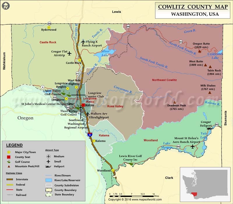
Check this Washington County Map to locate all the state’s counties in Washington Map.
Cowlitz County is located in southwestern Washington. Its county seat is Kelso and the largest city is Longview. The county was formed on April 21, 1854, and comprises a total area of 1,166 square miles. Interstate 5, State Route 4, and SR 504 are primary highways in Cowlitz County. The Amtrak train station at Kelso Multimodal Transportation Center is served by Cascades and Coast Starlight routes.
Longview, an erstwhile timber town, is a gateway to the Mount St. Helens National Volcanic Monument. The city of Castle Rock is located at the western base of 2,549-meter-tall Mount St. Helens. The county has dozens of parks with plenty of recreational and sightseeing opportunities. Harry Gardner Park offers RV camping sites, hiking trails, and playgrounds. Riverside Park features pathways, picnic shelters, and baseball fields. Seaquest State Park, Cowlitz County Historical Museum, Hoffstadt Bluffs Visitor Center, and Elk Rock Viewpoint are popular attractions in the region.
Facts about Cowlitz county in Washington |
|
|---|---|
| County Name | Cowlitz county |
| Population | 1,02,133 |
| Founded | 21 April 1854 |
| Area | 1,166 sq mi (3,020 sq km) |
| Land Area | 1,140 sq mi (2,953 sq km) |
| Water Area | 26 sq mi (67 sq km), 2.2% |
| Largest City | Longview |
| Cities | Longview, Kelso, Kalama, Castle Rock, Woodland, Ryderwood, Washington |
| County Seat | Kelso |
| Timezone | Pacific: UTC-8/-7 |

 Wall Maps