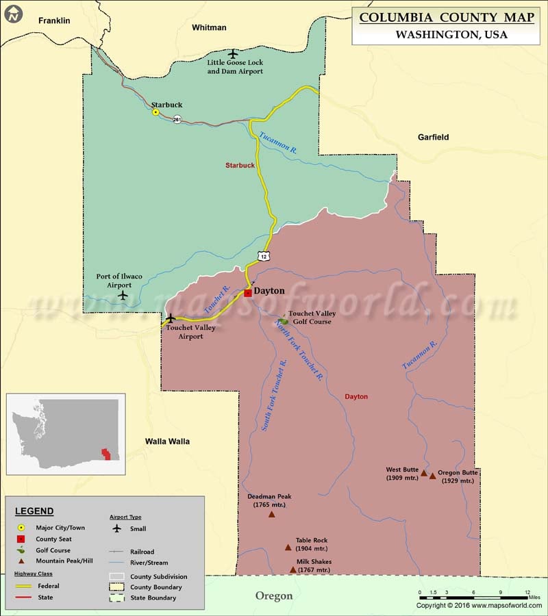
Check this Washington County Map to locate all the state’s counties in Washington Map.
Columbia County is located in southeastern Washington. The county was created on November 11, 1875, and is named after the Columbia River. Covering an area of 873 square miles, it is the third least populous county in Washington. Dayton is the county seat and its largest city. The county borders Whitman County to the north, Walla Walla and Garfield counties to the west and east respectively, and the Oregon state line to the south.
The northern portion of Columbia County features rolling hills and the Snake River Valley whereas, the terrain is rugged and forested to the south where the Blue Mountains rise up to 6,401 feet. Dayton is home to the oldest surviving train depot (1881) and the oldest working courthouse (1887) in Washington. The well-preserved Downtown Dayton Historic District includes 29 buildings in a four-block area. State Route 261 and U.S. Route 12 are the primary highways in the county. Ski Bluewood in Umatilla National Forest, Lewis and Clark Trail State Park, and Camp Wooten Retreat Center are popular places to visit in Columbia County.
More Maps of Columbia County
- Columbia County Map, Wisconsin
- Columbia County Map, Florida
- Columbia County Map, New York
- Columbia County Map, Georgia
Facts about Columbia county in Washington |
|
|---|---|
| County Name | Columbia county |
| Population | 3,985 |
| Founded | 11 November 1875 |
| Area | 874 sq mi (2,264 sq km) |
| Land Area | 869 sq mi (2,251 sq km) |
| Water Area | 4.9 sq mi (13 sq km), 0.6% |
| Largest City | Dayton |
| Cities | Dayton, Starbuck |
| County Seat | Dayton |
| Timezone | Pacific: UTC-8/-7 |

 Wall Maps