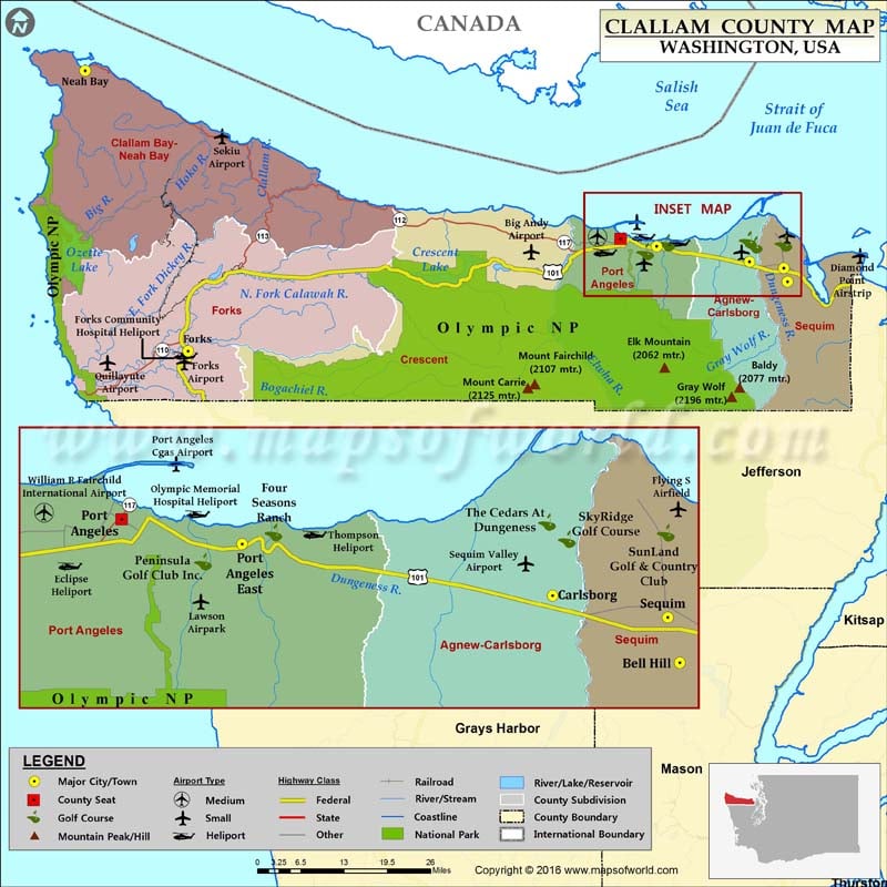
Check this Washington County Map to locate all the state’s counties in Washington Map.
Comprising a total area of 2,671 square miles on the Olympic Peninsula, Clallam County is located in western Washington. It was established on April 26, 1854. The county name is a Klallam word, meaning “the strong people.” Port Angeles is the largest city and county seat.
Cape Alava, the westernmost point in the contiguous United States, is in Clallam County. The county shares a land boundary with Jefferson County to the south and a water boundary with two districts of British Columbia, a Canadian province, to the north. To the east lies Puget Sound while the Pacific Ocean defines its western boundary. The city of Forks in Clallam County is the backdrop of popular Twilight Saga books and film series.
Olympic National Park, Dungeness National Wildlife Refuge, Rialto Beach, Ozette Lake, Sequim Bay State Park, and Salt Creek Recreation Area are some of the most-visited tourist attractions in the county. U.S. Route 101 passes through the cities of Forks, Sequim, and Port Angeles.
Facts about Clallam county in Washington |
|
|---|---|
| County Name | Clallam county |
| Population | 72,715 |
| Founded | 26 April 1854 |
| Area | 2,671 sq mi (6,918 sq km) |
| Land Area | 1,739 sq mi (4,504 sq km) |
| Water Area | 932 sq mi (2,414 sq km), 34.9% |
| Largest City | Port Angeles |
| Cities | Port Angeles, Sequim, Clallam Bay, Forks, Sekiu, La Push |
| County Seat | Port Angeles |
| Timezone | Pacific: UTC-8/-7 |

 Wall Maps