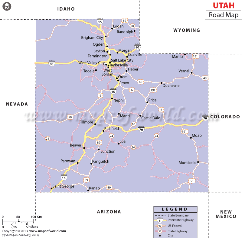
Interstate 70, Interstate 15, Interstate 84 and Interstate 80 are the prime highways of Utah. The east-west destinations of Utah state are served by Interstate 84, Interstate 70 and Interstate 80. Whereas Interstate 15 connects the north-south locations of the state. Indicating the wide-spread network, the Utah Road Map facilitates clear understanding of the roadways of the state.
Ogden, Salt Lake City and Provo are the three cities of Utah where bus transport facility is available. The Utah Department of Transportation is engaged with a range of activities such as maintenance, construction and repair of roads in the state. A total of 67, 354 km of roadways offer transportation services to the state of Utah, according to an official survey of 2000.
Salt Lake City, along with many towns such as Logan, Price, Milford, Roosevelt, Grantsville, Thompson, Beaver, Heber City, Ogden, Bluff, Emery, Moab, Levan and others is clearly indicated in the road map of Utah. The surrounding states that share border with Utah like Idaho, Wyoming, Nevada, Arizona and Colorado are also marked in the road map of the state. The Utah state map also provides a vivid illustration of the road routes of the place.

 Wall Maps