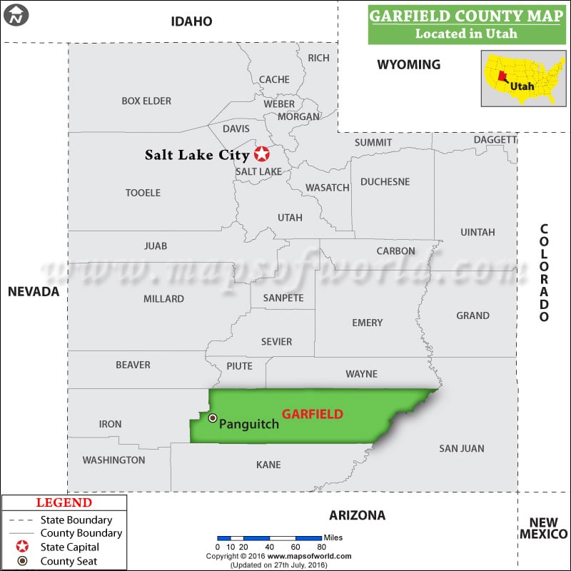
Facts about Garfield County
| County | Garfield |
| State | Utah |
| Country | USA |
| Population – 2015 | 5,009 |
More Maps of Garfield County
Garfield County is located in southeastern Washington. Established on November 29, 1881, the county covers an area of 718 square miles. Pomeroy is the county seat and the county’s only city. To the north lies the Snake River Valley while the Blue Mountains cover the county’s southern area. Garfield County is the least populous and the least densely populated county in Washington, with about 3.2 inhabitants per square mile.
The Snake River defines nearly all of its northern border. Agriculture, mostly wheat production, is the mainstay of the county’s economy. The campgrounds and hiking trails in Umatilla National Forest entice visitors to spend a rural weekend away from it all. Lower Granite Dam is another popular spot to enjoy fishing, picnicking, and water sports. US Route 12 is the major east-west corridor in the county and it passes through the city of Pomeroy.
List of Counties in Utah |
|||||
|---|---|---|---|---|---|
| County Name | County Seat/Capital | State | 2010 pop. | Area-km | Area-mi |
| Beaver | Beaver | Utah | 6,629 | 6,708 | 2,590 |
| Box Elder | Brigham City | Utah | 49,975 | 14,881 | 5,746 |
| Cache | Logan | Utah | 1,12,656 | 3,017 | 1,165 |
| Carbon | Price | Utah | 21,403 | 3,829 | 1,478 |
| Daggett | Manila | Utah | 1,059 | 1,805 | 697 |
| Davis | Farmington | Utah | 3,06,479 | 774 | 299 |
| Duchesne | Duchesne | Utah | 18,607 | 8,394 | 3,241 |
| Emery | Castle Dale | Utah | 10,976 | 11,557 | 4,462 |
| Garfield | Panguitch | Utah | 5,172 | 13,404 | 5,175 |
| Grand | Moab | Utah | 9,225 | 9,509 | 3,672 |
| Iron | Parowan | Utah | 46,163 | 8,538 | 3,297 |
| Juab | Nephi | Utah | 10,246 | 8,786 | 3,392 |
| Kane | Kanab | Utah | 7,125 | 10,335 | 3,990 |
| Millard | Fillmore | Utah | 12,503 | 17,023 | 6,572 |
| Morgan | Morgan | Utah | 9,469 | 1,578 | 609 |
| Piute | Junction | Utah | 1,556 | 1,963 | 758 |
| Rich | Randolph | Utah | 2,264 | 2,665 | 1,029 |
| Salt Lake | Salt Lake City | Utah | 10,29,655 | 1,923 | 742 |
| San Juan | Monticello | Utah | 14,746 | 20,254 | 7,820 |
| Sanpete | Manti | Utah | 27,822 | 4,118 | 1,590 |
| Sevier | Richfield | Utah | 20,802 | 4,948 | 1,911 |
| Summit | Coalville | Utah | 36,324 | 4,848 | 1,872 |
| Tooele | Tooele | Utah | 58,218 | 17,978 | 6,941 |
| Uintah | Vernal | Utah | 32,588 | 11,602 | 4,480 |
| Utah | Provo | Utah | 5,16,564 | 5,189 | 2,003 |
| Wasatch | Heber City | Utah | 23,530 | 3,045 | 1,176 |
| Washington | Saint George | Utah | 1,38,115 | 6,284 | 2,426 |
| Wayne | Loa | Utah | 2,778 | 6,373 | 2,461 |
| Weber | Ogden | Utah | 2,31,236 | 1,492 | 576 |

 Wall Maps