Texas Railway Network
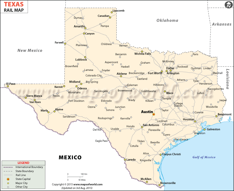
Texas Railway Map highlights the routes through which the trains of the state pass. Having a total of 9,600 miles of railway tracks (2016), Texas cities and towns are well-connected with an extensive network of rail lines.
The Texas state map marks the major rail routes of the place. Prominently marking the cities intersected by the train tracks, the railway map of Texas offers a comprehensive transportation guide.
In the year 1853 the first railroad of Texas came into existence which offered trains from Harrisburg to Stafford’s Point. Today the state of Texas is serviced by three prime railway companies namely Union Pacific, Kansas City Southern and Burlington Northern/Santa Fe. Amtrak is one of the most prominent rail service providers of Texas. The Texas Eagle of Amtrak covers the route of Chicago to San Antonio, whereas the Sunset Limited of Amtrak covers the route of New Orleans to Los Angeles. The towns and cities like that of San Antonio, Arlington, Dallas, Amarillo, Fort Worth, Lubbock, Corpus Christi, Abilene, Mc Allen, Austin and many others are prominently highlighted in the railway map of Texas. Tourist traveling through the trains of Texas can be facilitated by the railway map of the state.

 Wall Maps