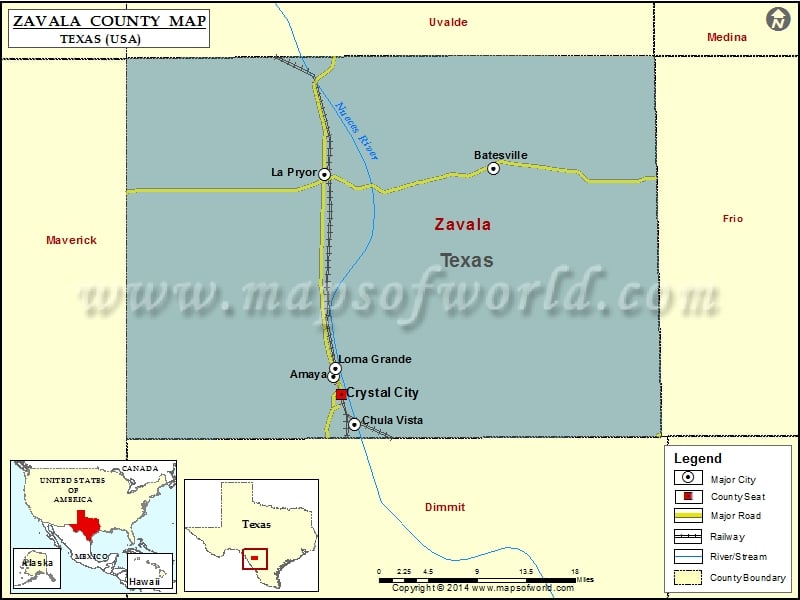
Check this Texas County Map to locate all the state’s counties in Texas Map. Mountain Peaks in Zavala County Mountain Peak/Hill Elevation [Meter] Batesville Hill 290 Buck Hill 248 Loma Vista Hill 217…
Check this Texas County Map to locate all the state’s counties in Texas Map .
Mountain Peaks in Zavala County
Mountain Peak/Hill
Elevation [Meter]
Batesville Hill
290
Buck Hill
248
Loma Vista Hill
217
Lone Tree Hill
264
Sand Mountain
263
Airports in Zavala County
Airport Name
Chacon Creek Ranch Airport
Chaparrosa Ranch Airport
Crystal City Municipal Airport
Dm Ranch Airport
Flying G Airport
H & F Properties Airport
Loma de Cometa Airport
Picosa Ranch Airport
R & J Livestock County Airport
Wagner-Braxdale Airport
Westwind Ranch Airport
Cities in Zavala County
City
Population
Latitude
Longitude
Amaya
93
28.712069
-99.83528
Batesville
1068
28.95519
-99.62378
Chula Vista
450
28.656343
-99.807701
Crystal City city
7138
28.690847
-99.825713
La Pryor
1643
28.948653
-99.848296
Loma Grande
107
28.722077
-99.832709

 Wall Maps