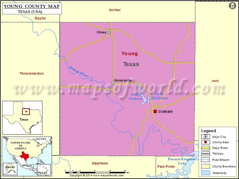
Check this Texas County Map to locate all the state’s counties in Texas Map. Mountain Peaks in Young County Mountain Peak/Hill Elevation [Meter] Bare Mountain 362 Bass Mountain 346 Beehive Mountain 419 Cement…
Check this Texas County Map to locate all the state’s counties in Texas Map .
Mountain Peaks in Young County
Mountain Peak/Hill
Elevation [Meter]
Bare Mountain
362
Bass Mountain
346
Beehive Mountain
419
Cement Mountain
410
Crow Peak
379
Dobbs Hill
347
Flag Mountain
417
Haynes Mountain
356
Indian Mountain
434
Kisinger Mountain
379
Rattlesnake Mountain
319
Round Mountain
349
Shin Oak Mountain
380
Sidney Mountain
353
Skid Mountain
371
Spy Knob
348
Tackett Mountain
406
Wolf Mountain
420
Airports in Young County
Airport Name
Graham Municipal Airport
Olney Municipal Airport
Rob Airport
Rosser Ranch Airport
Cities in Young County
City
Population
Latitude
Longitude
Graham city
8903
33.101652
-98.577852
Newcastle city
585
33.195034
-98.743561
Olney city
3285
33.364387
-98.75837
Golf Courses in Young County
Name of Golf Course
Latitude
Longitude
Graham Country Club-Graham
33.10768
-98.589521
Olney Recreation Assoc. & Country Club-Olney
33.37059
-98.752094

 Wall Maps