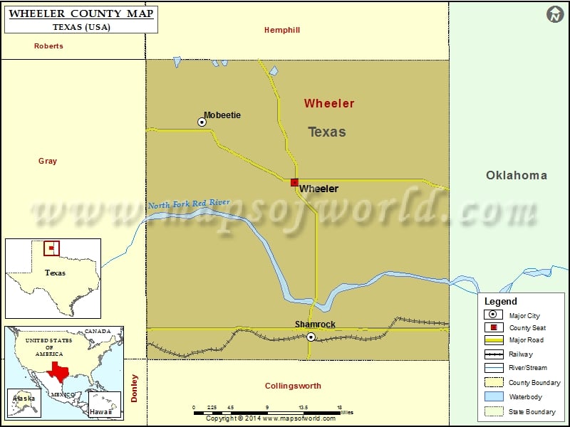
Check this Texas County Map to locate all the state’s counties in Texas Map. Mountain Peaks in Wheeler County Mountain Peak/Hill Elevation [Meter] Bankhead Mound 864 Lime Hill 869 More Maps of Wheeler…
Check this Texas County Map to locate all the state’s counties in Texas Map.
Mountain Peaks in Wheeler County
| Mountain Peak/Hill |
Elevation [Meter] |
| Bankhead Mound |
864 |
| Lime Hill |
869 |
More Maps of Wheeler County
Airports in Wheeler County
| Airport Name |
| Shamrock Municipal Airport |
| Wheeler Municipal Airport |
Cities in Wheeler County
| City |
Population |
Latitude |
Longitude |
| Mobeetie city |
101 |
35.529136 |
-100.439342 |
| Shamrock city |
1910 |
35.215402 |
-100.246085 |
| Wheeler city |
1592 |
35.441115 |
-100.275228 |
Golf Courses in Wheeler County
| Name of Golf Course |
Latitude |
Longitude |
| Shamrock Country Club-Shamrock |
35.222884 |
-100.250316 |

 Wall Maps