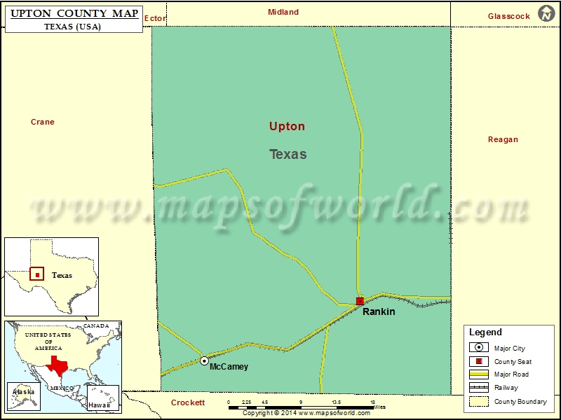
Check this Texas County Map to locate all the state’s counties in Texas Map. Mountain Peaks in Upton County Mountain Peak/Hill Elevation [Meter] Bobcat Hills 822 Castle Mountain 958 Cedar Hill 884 King…
Check this Texas County Map to locate all the state’s counties in Texas Map .
Mountain Peaks in Upton County
Mountain Peak/Hill
Elevation [Meter]
Bobcat Hills
822
Castle Mountain
958
Cedar Hill
884
King Mountain
958
Noelke Hill
922
Rattlesnake Butte
803
Square Top Mountain
921
Sugar Loaf Mountain
871
Table Top Mountain
918
Airports in Upton County
Airport Name
Rankin Airport
Upton County Airport
Cities in Upton County
City
Population
Latitude
Longitude
McCamey city
1887
31.13247
-102.22004
Rankin city
778
31.22536
-101.939437
Golf Courses in Upton County
Name of Golf Course
Latitude
Longitude
McCamey Country Club-McCamey
31.115314
-102.216626
Rankin Country Club-Rankin
31.233828
-101.931215

 Wall Maps