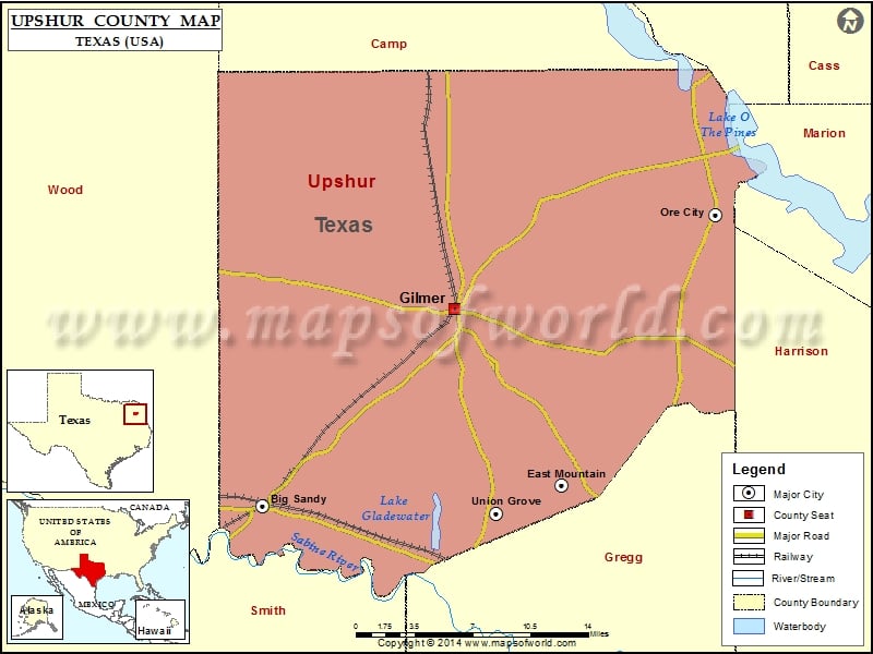
Check this Texas County Map to locate all the state’s counties in Texas Map. Mountain Peaks in Upshur County Mountain Peak/Hill Elevation [Meter] Adams Mountain 169 Barnwell Mountains 192 Brown Mountain 178 Camp…
Check this Texas County Map to locate all the state’s counties in Texas Map .
Mountain Peaks in Upshur County
Mountain Peak/Hill
Elevation [Meter]
Adams Mountain
169
Barnwell Mountains
192
Brown Mountain
178
Camp Mountain
187
East Mountain
200
Helms Mountain
159
Holiday Hill
163
Howell Mountain
185
Massey Mountain
160
McDonald Mountain
181
Peter Hayes Hill
137
Pinnacle Mountain
170
Simpson Mountain
188
Tidwell Mountain
191
Underwood Mountain
204
West Mountain
191
Airports in Upshur County
Airport Name
Alert Field
Etmc – Gilmer Heliport
Flying K Airport
Fox Stephens Field Gilmer Municipal Airport
Cities in Upshur County
City
Population
Latitude
Longitude
Big Sandy town
1343
32.585986
-95.112721
East Mountain city
797
32.600338
-94.852386
Gilmer city
4905
32.731805
-94.946028
Ore City city
1144
32.801046
-94.716699
Union Grove city
357
32.579779
-94.909592
Golf Courses in Upshur County
Name of Golf Course
Latitude
Longitude
Embassy Hills Golf Course-Big Sandy
32.637059
-95.090683
Gilmer Country Club-Gilmer
32.713778
-94.943687

 Wall Maps