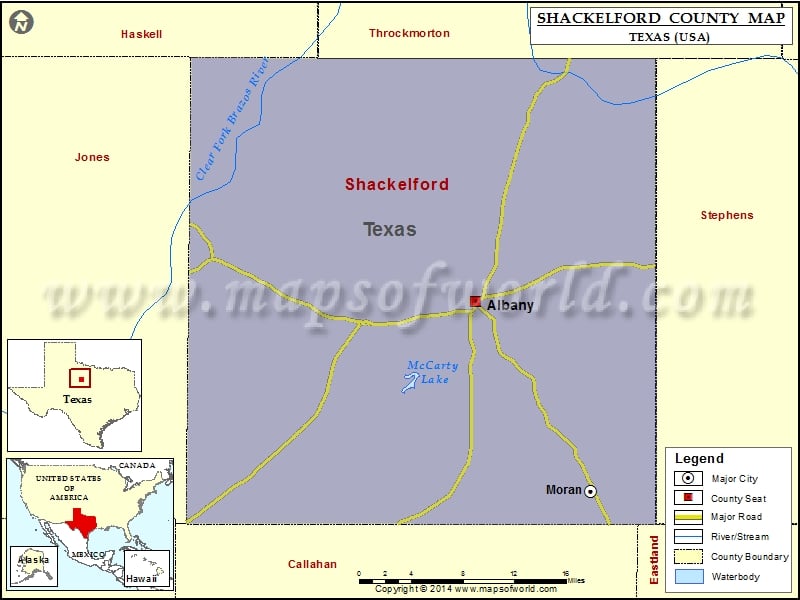
Shackelford County Map, Texas
Check this Texas County Map to locate all the state’s counties in Texas Map. Mountain Peaks in Shackelford County Mountain Peak/Hill Elevation [Meter] Antelope Hills 525 Flat Top 435 Flat Top 420 Greer…
Check this Texas County Map to locate all the state’s counties in Texas Map .
Mountain Peaks in Shackelford County
Mountain Peak/Hill
Elevation [Meter]
Antelope Hills
525
Flat Top
435
Flat Top
420
Greer Mountains
456
McCathrine Mountain
424
Mugginsville Mountain
431
Round Hill
455
Round Top Mountain
418
Airports in Shackelford County
Airport Name
Albany Municipal Airport
Portlock Airfield
Cities in Shackelford County
City
Population
Latitude
Longitude
Albany city
2034
32.727272
-99.295663
Moran city
270
32.547234
-99.166492
Golf Courses in Shackelford County
Name of Golf Course
Latitude
Longitude
Albany Golf Club-Albany
32.73179
-99.300249

 Wall Maps