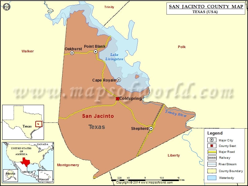
San Jacinto County Map, Texas
Check this Texas County Map to locate all the state’s counties in Texas Map. Mountain Peaks in San Jacinto County Mountain Peak/Hill Elevation [Meter] Camp Hill 61 Darby Hill 54 Liberty Hill 82…
Check this Texas County Map to locate all the state’s counties in Texas Map .
Mountain Peaks in San Jacinto County
Mountain Peak/Hill
Elevation [Meter]
Camp Hill
61
Darby Hill
54
Liberty Hill
82
Rocky Hill
77
Airports in San Jacinto County
Airport Name
Lake Bay Gall Airport
Lake Water Wheel Airport
Cities in San Jacinto County
City
Population
Latitude
Longitude
Cape Royale
670
30.653043
-95.126539
Coldspring city
853
30.589733
-95.130683
Oakhurst
233
30.743296
-95.307279
Point Blank city
688
30.747387
-95.216366
Shepherd city
2319
30.490952
-95.002054
Golf Courses in San Jacinto County
Name of Golf Course
Latitude
Longitude
Cape Royale Golf Course-Coldspring
30.657134
-95.127972
National Parks in San Jacinto County
Name of Park
Latitude
Longitude
Big Thicket N PRES
30.489963
-94.815144

 Wall Maps