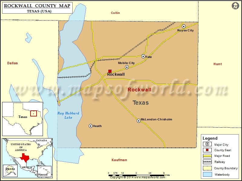
Rockwall County Map, Texas
Check this Texas County Map to locate all the state’s counties in Texas Map. Airports in Rockwall County Airport Name 5-State Heliport Klutts Field Lagrone Ranch Airport Presbyterian Hospital Of Rockwall Heliport Rives…
Check this Texas County Map to locate all the state’s counties in Texas Map .
Airports in Rockwall County
Airport Name
5-State Heliport
Klutts Field
Lagrone Ranch Airport
Presbyterian Hospital Of Rockwall Heliport
Rives Air Park
Rockwall Municipal Airport
Cities in Rockwall County
City
Population
Latitude
Longitude
Fate city
6357
32.939295
-96.38648
Heath City
6921
32.843929
-96.470982
McLendon-Chisholm city
1373
32.851217
-96.392372
Mobile City City
188
32.922873
-96.411129
Rockwall city
37490
32.917859
-96.439167
Royse City City
9349
32.977598
-96.324175
Golf Courses in Rockwall County
Name of Golf Course
Latitude
Longitude
A 1 Golf Center-Rockwall
32.918677
-96.424342
Buffalo Creek Golf Club-Rockwall
32.868234
-96.462025
Lakeside Village Golf Course-Rockwall
32.899426
-96.479907
Stone River Golf Club-Royse City
32.960229
-96.306271
The Shores Country Club-Rockwall
32.948838
-96.483396

 Wall Maps