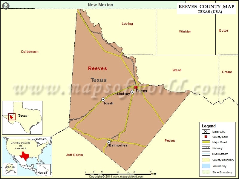
Check this Texas County Map to locate all the state’s counties in Texas Map. Mountain Peaks in Reeves County Mountain Peak/Hill Elevation [Meter] Beard Mountain 1459 Big Hill 928 Blue Goose Hill 788…
Check this Texas County Map to locate all the state’s counties in Texas Map .
Mountain Peaks in Reeves County
Mountain Peak/Hill
Elevation [Meter]
Beard Mountain
1459
Big Hill
928
Blue Goose Hill
788
Bullington Hill
909
Burnt Spring Hills
1035
Carpenter Hill
1110
Elkins Hills
1058
Florenzo Hill
1029
Goat Hill
1079
Johnson Hill
921
Meier Hills
1024
Negro Head
1279
New Well Hills
1054
Round Mountain
992
Saddle Back Mountains
1270
San Martine Peak
1222
Sotol Hill
1228
Airports in Reeves County
Airport Name
Pecos Municipal Airport
Seven Springs Airport
Cities in Reeves County
City
Population
Latitude
Longitude
Balmorhea city
479
30.984158
-103.743875
Lindsay
271
31.369077
-103.53753
Pecos city
8780
31.404615
-103.505678
Toyah town
90
31.312498
-103.794612
Golf Courses in Reeves County
Name of Golf Course
Latitude
Longitude
Reeves County Golf Course-Pecos
31.395037
-103.502601

 Wall Maps