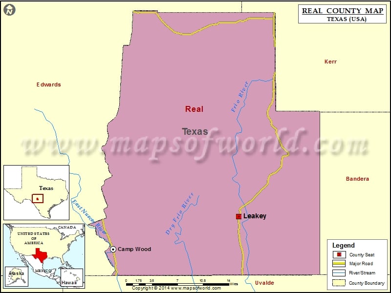
Check this Texas County Map to locate all the state’s counties in Texas Map. Mountain Peaks in Real County Mountain Peak/Hill Elevation [Meter] Bullhead Mountain 620 Caprock Mountain 695 Crown Mountain 617 Echo…
Check this Texas County Map to locate all the state’s counties in Texas Map .
Mountain Peaks in Real County
Mountain Peak/Hill
Elevation [Meter]
Bullhead Mountain
620
Caprock Mountain
695
Crown Mountain
617
Echo Mountain
626
Gobbler Knob
670
Hog Pen Mountain
657
Housetop Mountain
707
Meridian Mountain
626
Meridian Mountain
707
Turkey Peak
648
Turnpike Mountain
601
Airports in Real County
Airport Name
Casey Three Ranch Airport
Flying Bull Ranch Airport
Flying Bull Ranch Airport
Hackberry Ranch Airport
Prade Ranch Airport
Real County Airport
Cities in Real County
City
Population
Latitude
Longitude
Camp Wood city
706
29.669047
-100.010865
Leakey city
425
29.725358
-99.763098

 Wall Maps