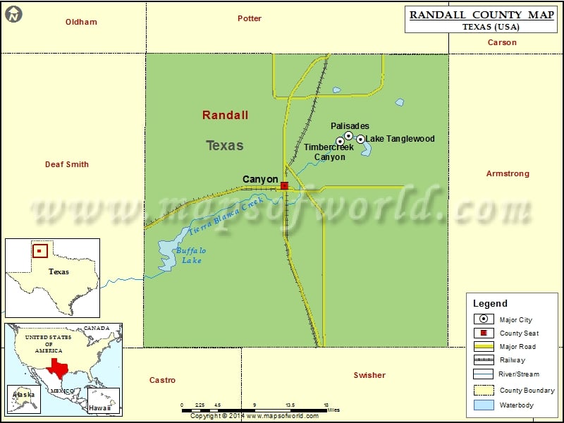
Randall County Map, Texas
Check this Texas County Map to locate all the state’s counties in Texas Map. Mountain Peaks in Randall County Mountain Peak/Hill Elevation [Meter] Brushy Butte 1032 Capitol Mesa 994 Capitol Peak 945 Castle…
Check this Texas County Map to locate all the state’s counties in Texas Map .
Mountain Peaks in Randall County
Mountain Peak/Hill
Elevation [Meter]
Brushy Butte
1032
Capitol Mesa
994
Capitol Peak
945
Castle Peak
1002
Cooley Butte
1034
Goodnight Peak
1000
Lighthouse Peak
989
Red Mesa
1015
Timber Mesa
988
Airports in Randall County
Airport Name
Blue Sky Airfield
Buffalo Airport
Flying K Airport
Maples Field
Palo Duro Airport
Tradewind Airport
Cities in Randall County
City
Population
Latitude
Longitude
Canyon city
13303
34.987773
-101.918372
Lake Tanglewood village
796
35.057171
-101.781727
Palisades village
325
35.061376
-101.803244
Timbercreek Canyon village
418
35.053805
-101.818595
Golf Courses in Randall County
Name of Golf Course
Latitude
Longitude
Canyon Country Club-Canyon
35.00629
-101.975391
Comanche Trail Golf Course-Amarillo
35.175831
-101.795606
Palo Duro Creek Golf Club-Canyon
34.994198
-101.926207
Preston West Par 3 Golf Course-Amarillo
35.116067
-101.919687

 Wall Maps