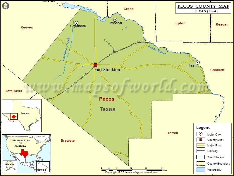
Check this Texas County Map to locate all the state’s counties in Texas Map. Mountain Peaks in Pecos County Mountain Peak/Hill Elevation [Meter] Big Baldy Peak 878 Big Mesa 898 Big Mesa 960…
Check this Texas County Map to locate all the state’s counties in Texas Map .
Mountain Peaks in Pecos County
Mountain Peak/Hill
Elevation [Meter]
Big Baldy Peak
878
Big Mesa
898
Big Mesa
960
Boat Hills
1314
Cap Rock Butte
1290
Cave Mesa
1336
Clark Butte
1460
Darrels Peak
911
Dimple Hills
1447
East Mesa
953
Fivemile Hill
972
Fivemile Mesa
1024
Flat Top
902
Girvin Butte
844
Guayule Mountain
957
Hayter Hill
1005
Hog Peak
918
Indian Mesa
947
Little Mesa
891
McKenzie Mesa
1010
North Mountain
1295
Panther Bluff
892
Panther Mesa
1280
Panther Peak
1275
Pikes Peak
1154
Pine Mesa
1411
Round Mountain
1091
Round Mountain
919
Saddle Butte
920
Sevenmile Mesa
887
Sherbino Mesa
990
Sierra Madera
1370
Skyscraper Peak
911
The Needle Point
908
Triple Butte
1107
Tucker Hill
990
Twelvemile Mesa
1139
Twomile Hill
961
Airports in Pecos County
Airport Name
Allison Ranch Airport
Canon Ranch Airport
Faith Cattle Company, Longfellow Ranch Airport
Fort Stockton Pecos County Airport
Iraan Municipal Airport
Smokey Mtn Ranch Airport
Cities in Pecos County
City
Population
Latitude
Longitude
Coyanosa
163
31.240978
-103.064828
Fort Stockton city
8283
30.892673
-102.885707
Imperial
278
31.266845
-102.69465
Iraan city
1229
30.912903
-101.900074
Golf Courses in Pecos County
Name of Golf Course
Latitude
Longitude
Desert Pnes Golf Course-Fort Stockton
30.884353
-102.890957
Iraan Golf Club-Iraan
30.69051
-101.823439

 Wall Maps