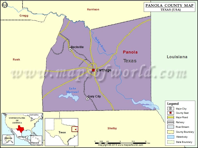
Check this Texas County Map to locate all the state’s counties in Texas Map. Mountain Peaks in Panola County Mountain Peak/Hill Elevation [Meter] Hog Mountain 90 Porter Hill 144 Risinger Hill 95 Sixmile…
Check this Texas County Map to locate all the state’s counties in Texas Map .
Mountain Peaks in Panola County
Mountain Peak/Hill
Elevation [Meter]
Hog Mountain
90
Porter Hill
144
Risinger Hill
95
Sixmile Hill
96
Stonewall Hill
97
The Sand Hills
134
Airports in Panola County
Airport Name
Panola County Sharpe Field
Panola General Hospital Heliport
Cities in Panola County
City
Population
Latitude
Longitude
Beckville city
847
32.243602
-94.456087
Carthage city
6779
32.152575
-94.336811
Gary City town
311
32.027728
-94.367901
Golf Courses in Panola County
Name of Golf Course
Latitude
Longitude
Carthage Country Club-Carthage
32.16182
-94.376266

 Wall Maps