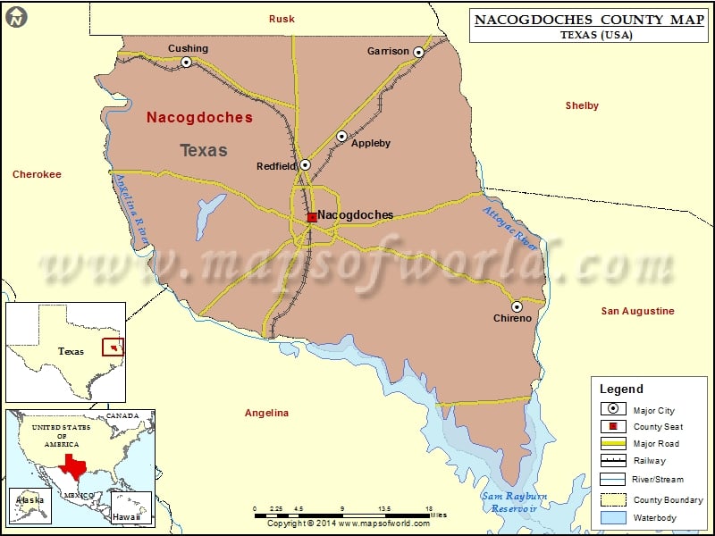
Nacogdoches County Map, Texas
Check this Texas County Map to locate all the state’s counties in Texas Map. Mountain Peaks in Nacogdoches County Mountain Peak/Hill Elevation [Meter] Beard Mountain 160 Button Mountain 221 Denny Mountain 188 Flower…
Check this Texas County Map to locate all the state’s counties in Texas Map .
Mountain Peaks in Nacogdoches County
Mountain Peak/Hill
Elevation [Meter]
Beard Mountain
160
Button Mountain
221
Denny Mountain
188
Flower Mountain
211
The Island
67
Airports in Nacogdoches County
Airport Name
A L Mangham Jr. Regional Airport
Barton Memorial Airport
R D Williams Airport
Cities in Nacogdoches County
City
Population
Latitude
Longitude
Appleby city
474
31.717028
-94.60777
Chireno city
386
31.498948
-94.345855
Cushing city
612
31.812598
-94.841142
Garrison city
895
31.825179
-94.49314
Nacogdoches city
32996
31.613759
-94.652836
Redfield
441
31.680509
-94.662876
Golf Courses in Nacogdoches County
Name of Golf Course
Latitude
Longitude
Piney Woods Country Club-Nacogdoches
31.642661
-94.683673
Woodland Hills Golf Club-Nacogdoches
31.53232
-94.689513

 Wall Maps