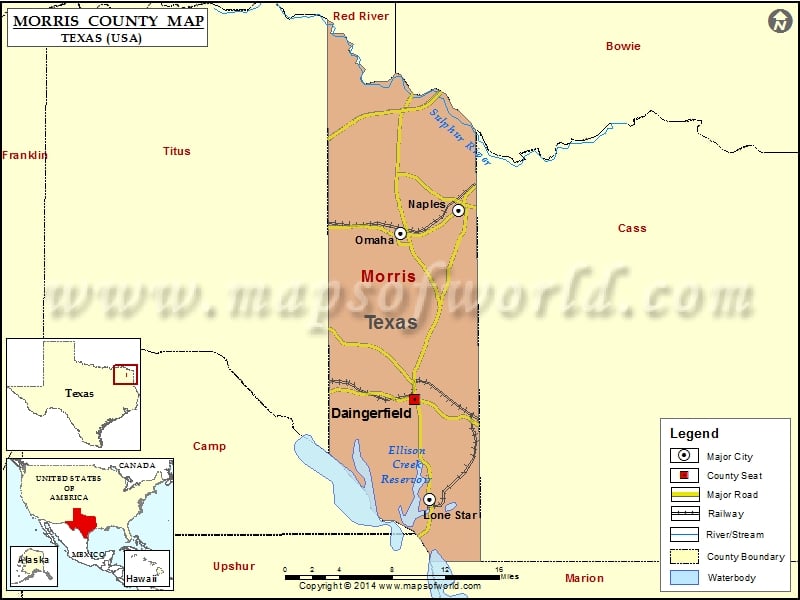
Check this Texas County Map to locate all the state’s counties in Texas Map. Mountain Peaks in Morris County Mountain Peak/Hill Elevation [Meter] Buzzard Roost Mountain 163 Fowler Mountain 151 Pat Miller Hill…
Check this Texas County Map to locate all the state’s counties in Texas Map .
Mountain Peaks in Morris County
Mountain Peak/Hill
Elevation [Meter]
Buzzard Roost Mountain
163
Fowler Mountain
151
Pat Miller Hill
121
Airports in Morris County
Airport Name
David Granberry Memorial Hospital Heliport
Greater Morris County Airport
Lone Star Steel Company Airport
Cities in Morris County
City
Population
Latitude
Longitude
Daingerfield city
2560
33.030589
-94.725098
Lone Star city
1581
32.939281
-94.709048
Naples city
1378
33.202936
-94.677705
Omaha city
1021
33.182176
-94.740342
Golf Courses in Morris County
Name of Golf Course
Latitude
Longitude
Beaver Brook Country Club-Daingerfield
33.000525
-94.656664

 Wall Maps