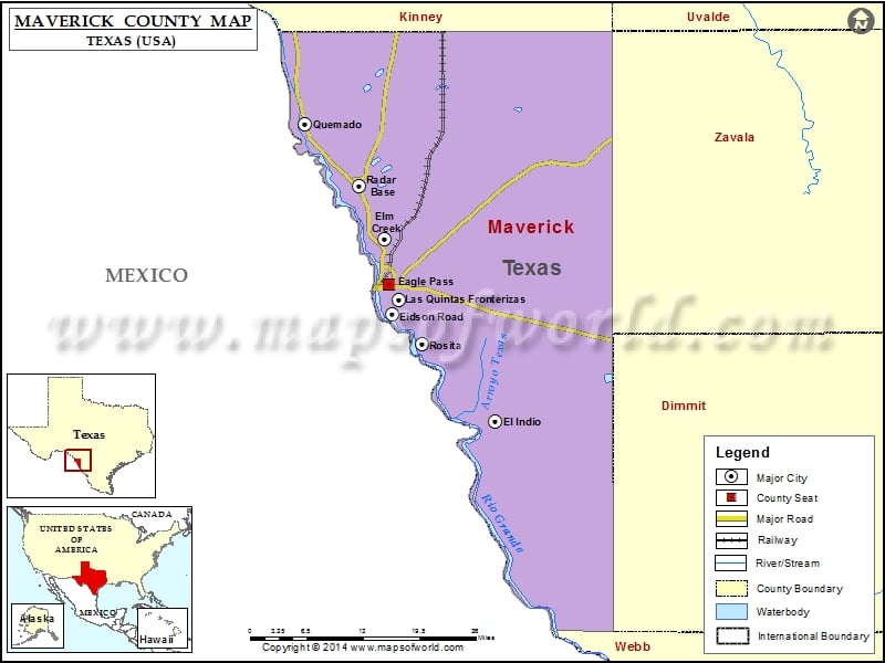
Maverick County Map, Texas
Check this Texas County Map to locate all the state’s counties in Texas Map. Mountain Peaks in Maverick County Mountain Peak/Hill Elevation [Meter] Chapotal Hill 282 Consuelo Hill 263 Deadmans Hill 276 Airports…
Check this Texas County Map to locate all the state’s counties in Texas Map .
Mountain Peaks in Maverick County
Mountain Peak/Hill
Elevation [Meter]
Chapotal Hill
282
Consuelo Hill
263
Deadmans Hill
276
Airports in Maverick County
Airport Name
Comanche Ranch Airport
Dunbar Ranch Airport
Fort Duncan Medical Center Heliport
Glass Ranch Airport
Hughes Ranch Airport
Indio-Faith Airport
Maverick County Memorial International Airport
Winn Exploration Co. Inc Airport
Cities in Maverick County
City
Population
Latitude
Longitude
Chula Vista
3818
28.657305
-100.421992
Eagle Pass city
26248
28.711766
-100.482982
Eidson Road
8960
28.667769
-100.478861
El Indio
190
28.509153
-100.306741
Elm Creek
2469
28.778247
-100.491019
Fabrica
923
28.744681
-100.493396
Las Quintas Fronterizas
3290
28.688896
-100.467519
Quemado
230
28.94722
-100.623819
Radar Base
762
28.856852
-100.533601
Rosita
2704
28.624345
-100.428703
Seco Mines
560
28.746768
-100.502624
Siesta Acres
1885
28.756378
-100.491015
Golf Courses in Maverick County
Name of Golf Course
Latitude
Longitude
Eagle Pass Golf Club-Eagle Pass
28.702195
-100.504512

 Wall Maps