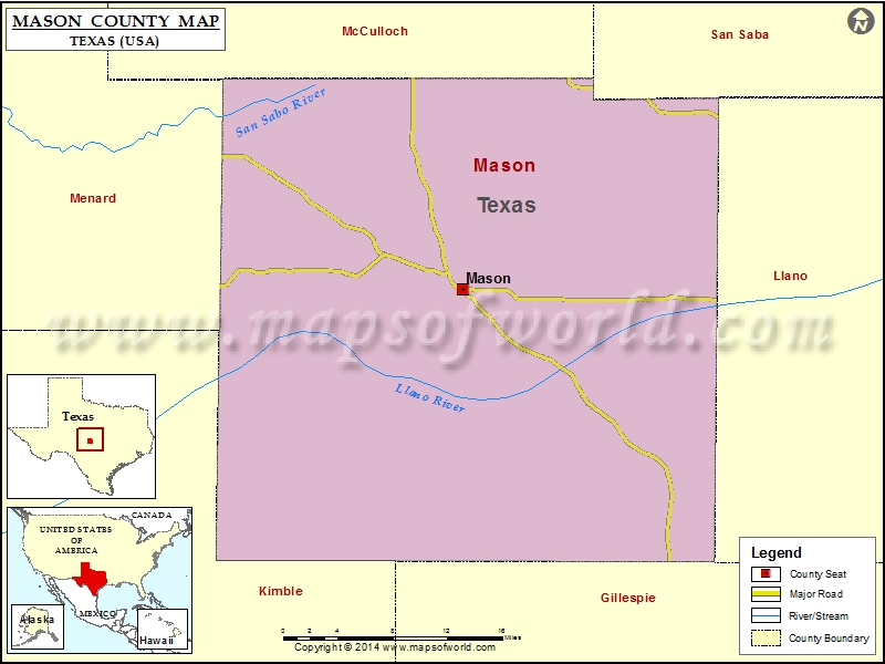
Check this Texas County Map to locate all the state’s counties in Texas Map. Mountain Peaks in Mason County Mountain Peak/Hill Elevation [Meter] Bill Hill 520 Bodie Peak 486 Cutoff Mountain 593 Double…
Check this Texas County Map to locate all the state’s counties in Texas Map.
Mountain Peaks in Mason County
| Mountain Peak/Hill |
Elevation [Meter] |
| Bill Hill |
520 |
| Bodie Peak |
486 |
| Cutoff Mountain |
593 |
| Double Knobs |
603 |
| Eckert Roughs |
510 |
| Flat Rock |
517 |
| Flathead Point |
583 |
| Hairy Knob |
552 |
| Haystack Mountain |
587 |
| Jordan Mountain |
472 |
| Katemcy Rocks |
532 |
| Lime Peak |
598 |
| Loyal Mountain |
544 |
| Man Mountain |
536 |
| Mason Mountain |
571 |
| Mason Mountains |
609 |
| Meusebach Mountain |
508 |
| Monument Mountain |
660 |
| Nixon Mountain |
578 |
| Purdy Hill |
562 |
| Shaft Mountain |
516 |
| Spring Hill |
506 |
| Spy Rock |
528 |
| Todd Mountain |
524 |
| Tom Green Mountain |
553 |
| Turkey Hill |
470 |
| Turkeyroost Mountain |
525 |
More Maps of Mason County
Airports in Mason County
| Airport Name |
| Eagle Rock Ranch Airport |
| Mason County Airport |
| Polk Ranch Airport |
| Smith I-Ranch Airport |
Cities in Mason County
| City |
Population |
Latitude |
Longitude |
| Mason city |
2114 |
30.748003 |
-99.228744 |
Golf Courses in Mason County
| Name of Golf Course |
Latitude |
Longitude |
| Comanche Creek Golf Course-Mason |
30.748805 |
-99.231564 |

 Wall Maps