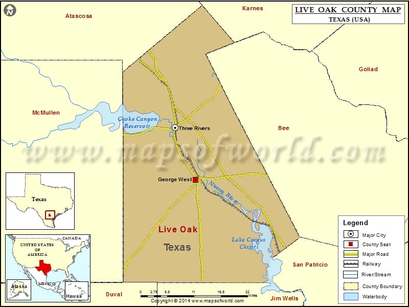
Check this Texas County Map to locate all the state’s counties in Texas Map. Mountain Peaks in Live Oaks County Mountain Peak/Hill Elevation [Meter] Balania Hill 64 Carmel Hills 46 Comanche Hills 75…
Check this Texas County Map to locate all the state’s counties in Texas Map.
Mountain Peaks in Live Oaks County
| Mountain Peak/Hill |
Elevation [Meter] |
| Balania Hill |
64 |
| Carmel Hills |
46 |
| Comanche Hills |
75 |
| Odom Hill |
110 |
Airports in Live Oaks County
| Airport Name |
| Arrowhead Airport |
| Beefmaster’s Best Airport |
| Live Oak County Airport |
| Los Ebanos Ranch Airport |
| Rossler Ranch Airport |
Cities in Live Oaks County
| City |
Population |
Latitude |
Longitude |
| George West city |
2445 |
28.33 |
-98.118304 |
| Three Rivers city |
1848 |
28.466863 |
-98.178417 |

 Wall Maps