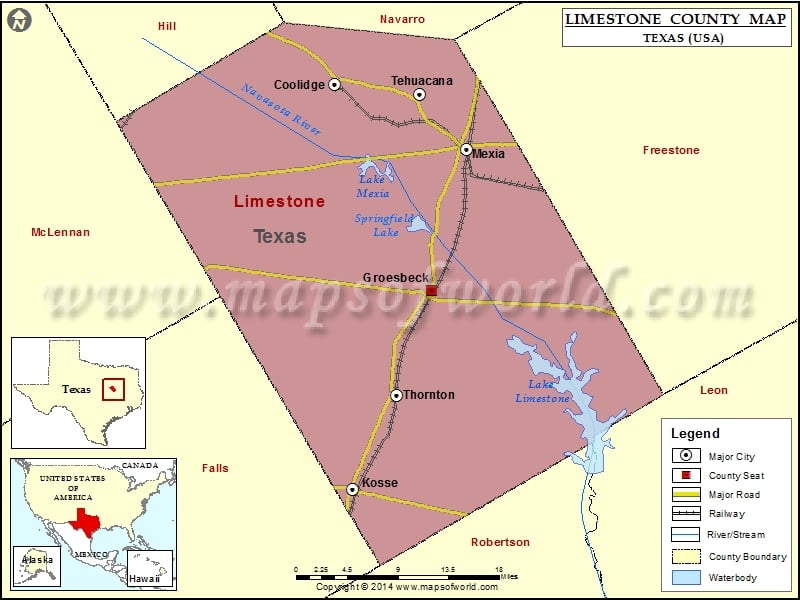
Check this Texas County Map to locate all the state’s counties in Texas Map. Mountain Peaks in Limestone County Mountain Peak/Hill Elevation [Meter] Andrews Hill 140 Bald Hill 186 Cedar Mound 113 Horn…
Check this Texas County Map to locate all the state’s counties in Texas Map.
Mountain Peaks in Limestone County
| Mountain Peak/Hill |
Elevation [Meter] |
| Andrews Hill |
140 |
| Bald Hill |
186 |
| Cedar Mound |
113 |
| Horn Hill |
201 |
| Morgan Hill |
174 |
| Tehuacana Hills |
195 |
More Maps of Limestone County
Airports in Limestone County
| Airport Name |
| Mexia Limestone County Airport |
| Pt Enterprise D&W Ranch Airport |
Cities in Limestone County
| City |
Population |
Latitude |
Longitude |
| Coolidge town |
955 |
31.751386 |
-96.652379 |
| Groesbeck city |
4328 |
31.52581 |
-96.528369 |
| Kosse town |
464 |
31.306982 |
-96.629227 |
| Mexia city |
7459 |
31.68085 |
-96.483285 |
| Tehuacana town |
283 |
31.741026 |
-96.543617 |
| Thornton town |
526 |
31.411133 |
-96.573857 |

 Wall Maps