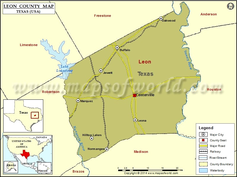
Check this Texas County Map to locate all the state’s counties in Texas Map. Mountain Peaks in Leon County Mountain Peak/Hill Elevation [Meter] Hayden Mountain 123 Payne Hill 137 More Maps of Leon…
Check this Texas County Map to locate all the state’s counties in Texas Map .
Mountain Peaks in Leon County
Mountain Peak/Hill
Elevation [Meter]
Hayden Mountain
123
Payne Hill
137
More Maps of Leon County
Airports in Leon County
Airport Name
Carter Ranch Airport
Dillard Ranch Airport
Hilltop Lakes Airport
Hub Field
Miles Field
Moore Ranch Airport
Morris Lazy K Ranch Airport
Nucor Ems Heliport
Wood Crest Ranch Airport
Cities in Leon County
City
Population
Latitude
Longitude
Buffalo city
1856
31.460361
-96.064824
Centerville city
892
31.258129
-95.979667
Hilltop Lakes
1101
31.075539
-96.191456
Jewett city
1167
31.362575
-96.145685
Leona city
175
31.153708
-95.975988
Marquez city
263
31.236515
-96.25723
Normangee town
685
31.030023
-96.116091
Oakwood town
510
31.584788
-95.849878
Golf Courses in Leon County
Name of Golf Course
Latitude
Longitude
Hilltop Lakes Resort Golf Club-Hilltop Lakes
31.088521
-96.202739

 Wall Maps