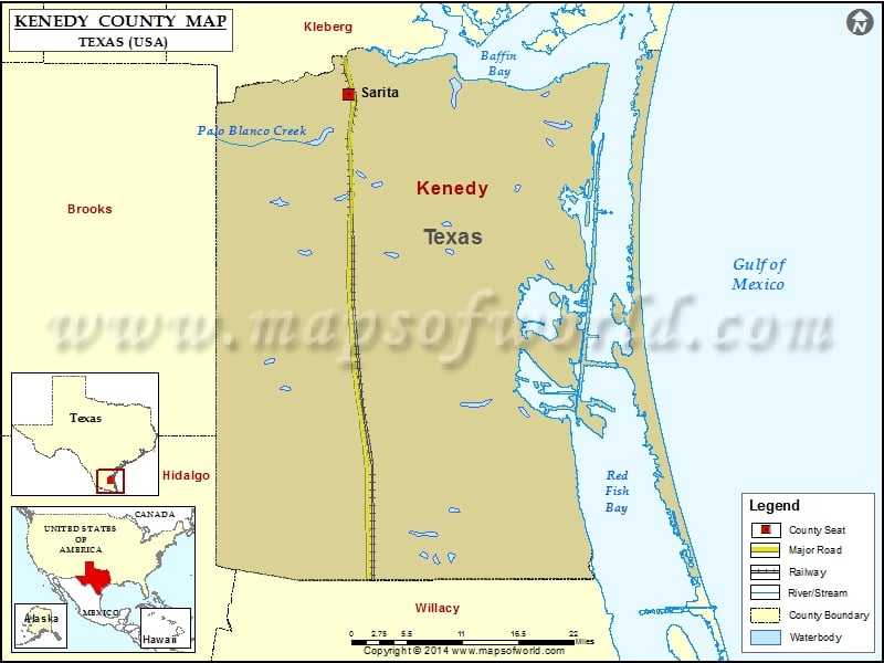
Check this Texas County Map to locate all the state’s counties in Texas Map. Mountain Peaks in Kenedy County Mountain Peak/Hill Elevation [Meter] Alto de la Cruz 20 Candelaria Hill 16 Divisadero 13…
Check this Texas County Map to locate all the state’s counties in Texas Map .
Mountain Peaks in Kenedy County
Mountain Peak/Hill
Elevation [Meter]
Alto de la Cruz
20
Candelaria Hill
16
Divisadero
13
Ebony Hill
12
El Toro
5
Loma Prieta
12
Mota Casa
6
Mota Negra
3
Potrero Cortado
5
Potrero de las Canelas
3
Potrero de los Caballos
3
Potrero Farias
2
Potrero Grande
3
Potrero Lopeno
6
Rincon de San Jose
2
Southeast Point
3
Tokyo Hill
9
Airports in Kenedy County
Airport Name
Armstrong Ranch Airport
Cities in Kenedy County
City
Population
Latitude
Longitude
Sarita
238
27.223509
-97.795077
National Parks in Kenedy County
Name of Park
Latitude
Longitude
Padre Island NS
27.054559
-97.357305

 Wall Maps