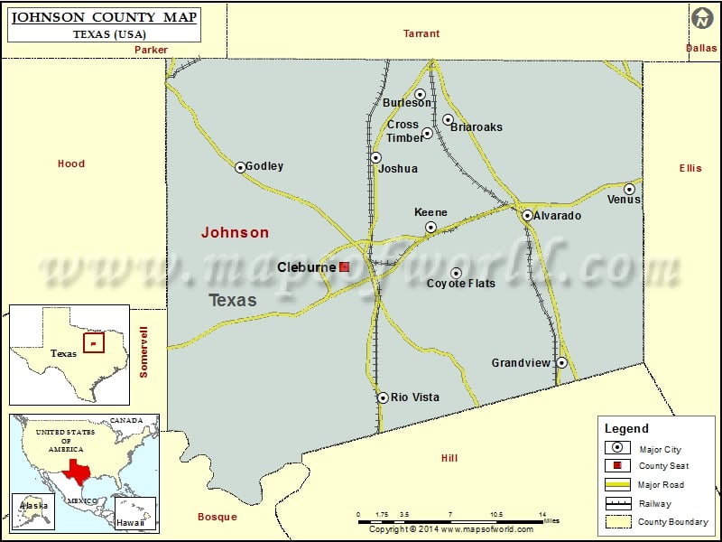
Johnson County Map, Texas
Check this Texas County Map to locate all the state’s counties in Texas Map. Mountain Peaks in Johnson County Mountain Peak/Hill Elevation [Meter] Berry Knob 285 Brushy Knob 303 Caddo Peak 303 Poverty…
Check this Texas County Map to locate all the state’s counties in Texas Map .
Mountain Peaks in Johnson County
Mountain Peak/Hill
Elevation [Meter]
Berry Knob
285
Brushy Knob
303
Caddo Peak
303
Poverty Knob
216
Turkey Peak
266
More Maps of Johnson County
Airports in Johnson County
Airport Name
Allen Ponderosa Heliport
Aresti Aerodrome
Benjamin Franklin Airport
Block Ranch Airport
Brabsom Farm Airport
Buffalo Chips Airpark
Carroll Lake-View Airport
Chicken Strip
Chigger Field
Cleburne Municipal Airport
Coppenger Farm Airport
Cow Pasture Airport
Double A Airport
Drennan Airport
Embry Ranch Airport
Eric Marcus Municipal Airport
Flying B Ranch Airport
Flying L Airpark
Flying M Ranch Airport
Flying W Heliport
Goodlett Field
Grand Valley Lands Airport
Grand Valley Lands Airport
Hawkins Private Airport
Luscombe Acres Airport
Marana Regional Airport
Peacock Willow Creek Heliport
Phillips Farm Airport
Rafter J Airport
Retta Airport
Short Field
Stol Field
Thomas Flying Field
Venus Airport
Cities in Johnson County
City
Population
Latitude
Longitude
Alvarado city
3785
32.406707
-97.214714
Briaroaks city
492
32.49578
-97.303316
Burleson city
36690
32.52009
-97.334109
Cleburne city
29337
32.353038
-97.406734
Coyote Flats
312
32.352812
-97.294409
Cross Timber town
268
32.48324
-97.325928
Godley city
1009
32.451248
-97.532198
Grandview city
1561
32.268495
-97.177497
Joshua city
5910
32.460734
-97.382997
Keene city
6106
32.395451
-97.322479
Rio Vista city
873
32.235228
-97.374653
Venus town
2960
32.430796
-97.101715
Golf Courses in Johnson County
Name of Golf Course
Latitude
Longitude
Cleburne Golf Ranch-Cleburne
32.381313
-97.387444
Cleburne Municipal Golf Course-Cleburne
32.308491
-97.418907
Hidden Creek Golf Course-Burleson
32.525659
-97.312115
Jacksboro Country Club-Jacksboro
32.46522
-97.427319
Mountain Valley Country Club-Joshua
32.488268
-97.365822
Riverview Golf Club-Cleburne
32.294991
-97.410345
The Retreat-Cleburne
32.226359
-97.521231

 Wall Maps