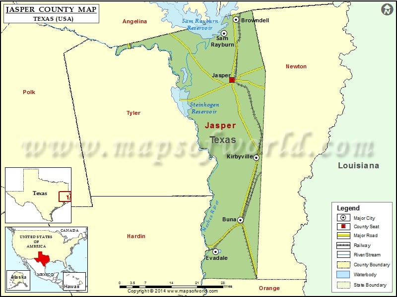
Check this Texas County Map to locate all the state’s counties in Texas Map. Mountain Peaks in Jasper County Mountain Peak/Hill Elevation [Meter] Bald Hill 111 Hi Truett Hill 143 Lynch Hill 45…
Check this Texas County Map to locate all the state’s counties in Texas Map.
Mountain Peaks in Jasper County
| Mountain Peak/Hill |
Elevation [Meter] |
| Bald Hill |
111 |
| Hi Truett Hill |
143 |
| Lynch Hill |
45 |
| McGee Hill |
78 |
| Pace Hill |
72 |
| Spring Hill |
69 |
More Maps of Jasper County
Airports in Jasper County
| Airport Name |
| Ben Bruce Memorial Airpark |
| Jasper County-Bell Field |
| Kirbyville Airport |
| Tgp 32 Heliport |
Cities in Jasper County
| City |
Population |
Latitude |
Longitude |
| Browndell city |
197 |
31.125374 |
-93.980138 |
| Buna |
2142 |
30.445771 |
-93.962464 |
| Evadale |
1483 |
30.33694 |
-94.059957 |
| Jasper city |
7590 |
30.922052 |
-93.994748 |
| Kirbyville city |
2142 |
30.657781 |
-93.900081 |
| Sam Rayburn |
1181 |
31.078879 |
-94.026572 |
Golf Courses in Jasper County
| Name of Golf Course |
Latitude |
Longitude |
| Jasper Country Club-Jasper |
30.970145 |
-93.985989 |
| Rayburn Country Club-Brookeland |
31.074127 |
-94.023042 |
National Parks in Jasper County
| Name of Park |
Latitude |
Longitude |
| Big Thicket N PRES |
30.344357 |
-94.267845 |

 Wall Maps