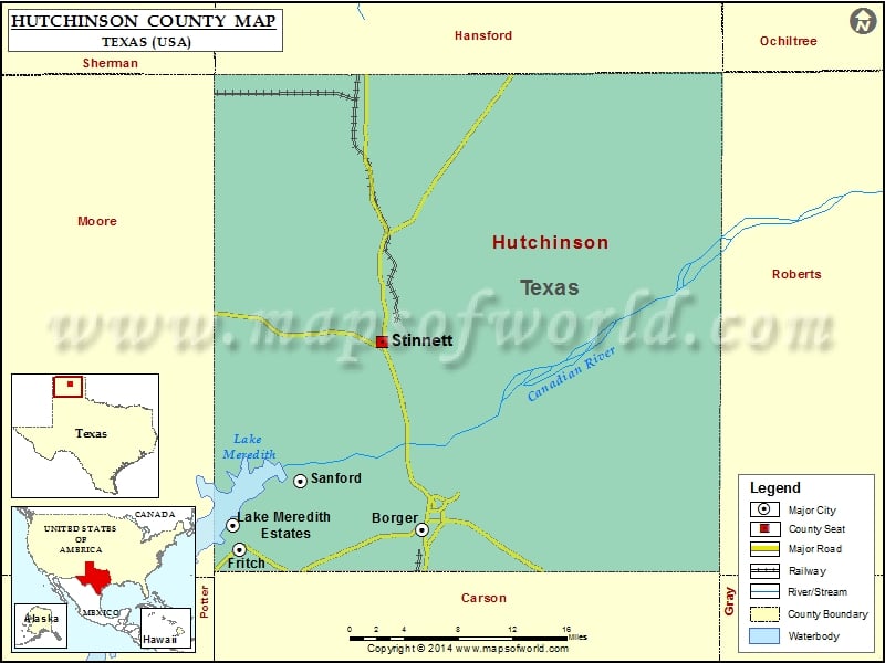
Hutchinson County Map, Texas
Check this Texas County Map to locate all the state’s counties in Texas Map. Mountain Peaks in Hutchinson County Mountain Peak/Hill Elevation [Meter] Signal Hill 986 More Maps of Hutchinson County Hutchinson County…
Check this Texas County Map to locate all the state’s counties in Texas Map .
Mountain Peaks in Hutchinson County
Mountain Peak/Hill
Elevation [Meter]
Signal Hill
986
More Maps of Hutchinson County
Airports in Hutchinson County
Airport Name
Hutchinson County Airport
Cities in Hutchinson County
City
Population
Latitude
Longitude
Borger city
13251
35.659824
-101.401154
Fritch city
2117
35.643066
-101.596432
Lake Meredith Estates
437
35.663849
-101.602732
Sanford town
164
35.702624
-101.531771
Stinnett city
1881
35.823093
-101.44362
Golf Courses in Hutchinson County
Name of Golf Course
Latitude
Longitude
Borger Country Club-Borger
35.639457
-101.451321
Phillips Country Club-Borger
35.684097
-101.399056
National Parks in Hutchinson County
Name of Park
Latitude
Longitude
Lake Meredith NRA
35.619102
-101.681212

 Wall Maps